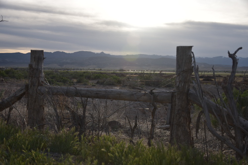
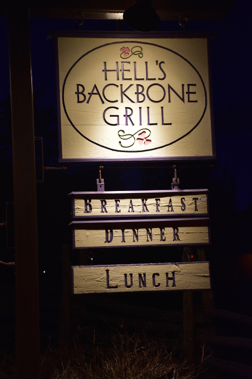
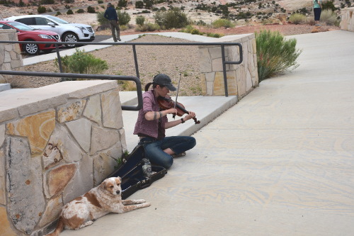
Sue and I took a 9 day trip to Utah from May 4th through the 13th. The motivation for the trip, well... from my viewpoint, anyway, was to fulfill my current, one and only item on my "Bucket List": to have dinner at Hell's Backbone Grill in Boulder, UT. And from Sue's viewpoint, she's happy to come along to HBG, but she has always wanted to see this part of the country.
And just why, you may ask, would dinner at some remote (very remote) restaurant in Utah make it onto my bucket list? Well, in the summer of 2006, I received an email from Dolly Spalding, who was the wife of my former classical guitar teacher, Walter Spalding. She had contacted me to tell me that sadly Walter had passed away in 2004. I had studied with Walter for 3 years back in the mid 1970s at their home in Kingston, NH. We fell into contact after she found a reference to Walter here on my web site (probably from this entry on one of the early pages from the site).
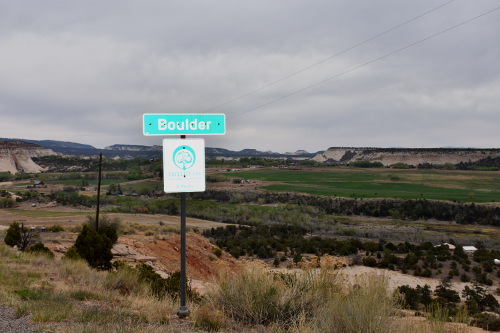
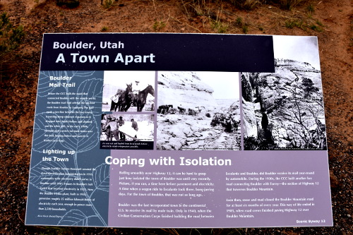
One of their daughters, Blake, and a partner created a restaurant in Boulder, Utah called Hell's Backbone Grill. Turns out that Boulder, UT is one of the most remote towns in the country: something like a 5 hour drive through the wilderness from Salt Lake City. Located in the heart of the Grand Staircase-Escalante National Monument, Boulder, Utah, was the last town in the nation to receive year-round mail by automobile. Today it has no stoplight, cell phone service, ATM, grocery store or medical facilities. But it has their Zagat-rated Hell's Backbone Grill!
Dolly told me that Blake had written a book about the restaurant and cooking called, With a Measure of Grace. She sent an autographed copy of it to me as a gift for helping her redesign the website for the Arizona Onstage Productions theater group in Tuscon, AZ that she works with. That was it: I was hooked, created a bucket list, and put dinner at Hell's Backbone Grill on it!
Getting Around
Because this report is really long, the below links will allow you to jump to where you left off reading:
Beginnings
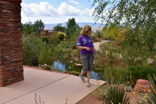
Sue and I had both wanted to take a trip out West, and thought we could combine visiting my nephew Dean, who lives in Pocatello, ID, with exploring that area down to Hell's Backbone Grill. Unfortunately, our plans to meet up with Dean didn't work out. We ended up flying into Salt Lake City, UT, and spending 9 days driving south, stopping in Salina, Boulder, Cannonville, La Verkin, and St. George, flying out of St. George on the 13th.
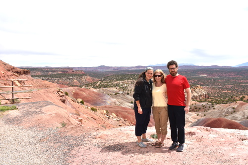
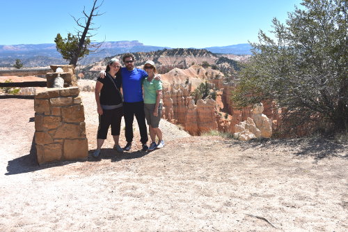
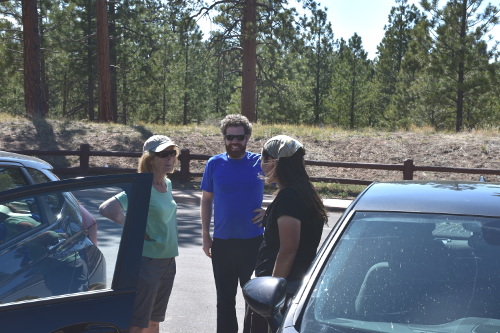
It was a terrific trip, made even more special when Sue's kids Lucas and Jill were able to join us for dinner at Hell's Backbone Grill, and then see Bryce Canyon with us the next day before heading for their homes.
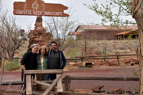
Jill had flown into Los Angeles, CA from her home in Westerly, RI to meet up with Lucas who had moved to L.A. recently. From there, they drove to Torrey, UT where we met them for brunch before visiting Capitol Reef National Park, and then continuing on to Boulder, UT, and beyond!!!.
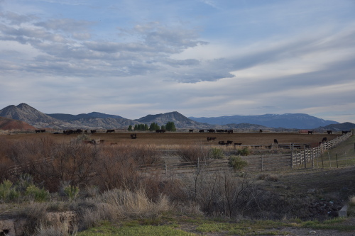
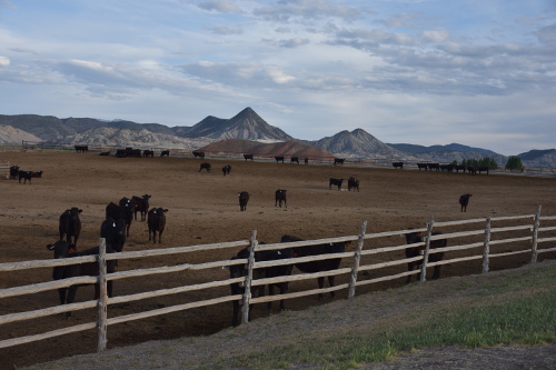
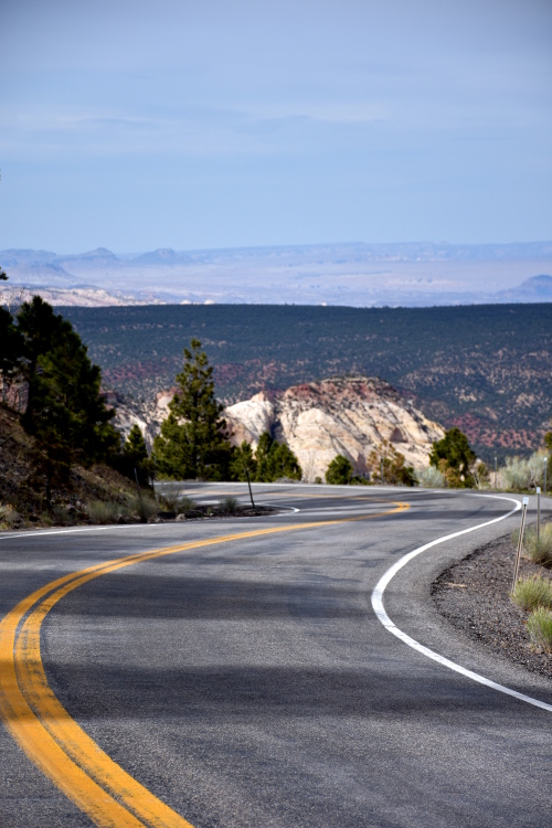
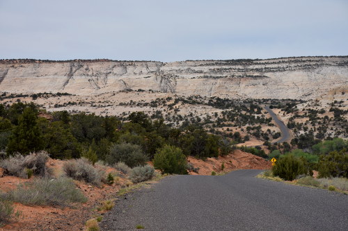
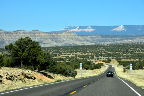
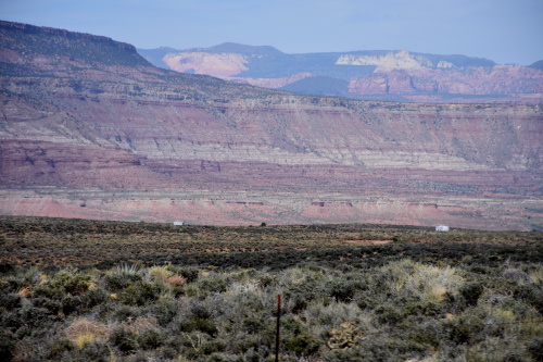
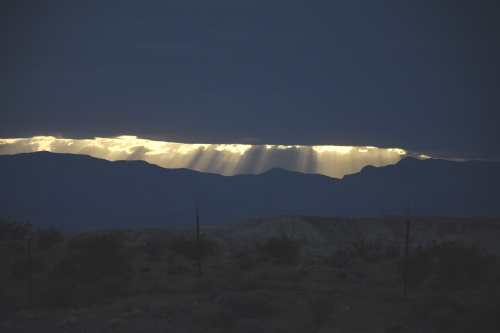
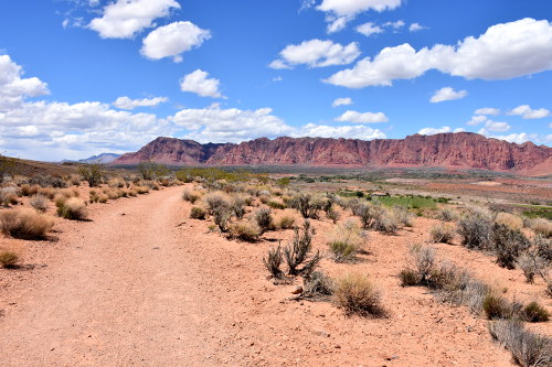
If we had driven the main roads, our entire trip would have been 465 or so miles. We not only didn't travel the main roads, but we took numerous side trips out to different areas from each place we stayed. We probably did 900 or so miles; a lot of driving. Some of it was across high desert areas, but most was up and down mountains, many times on 14 percent grades and doing just 20 mph, over nail biting, narrow, switch-backs.
Many times the roadsides fall away many hundreds of feet, and on the 11.5 miles across The Hogsback on Highway 12 south of Boulder, UT on the way to Escalante, falling away for over a thousand feet on both sides!
FB picture by Ben Prepelka as we were way too f'n tense to be taking pictures crossing The Hogsback!
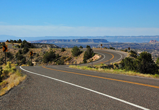
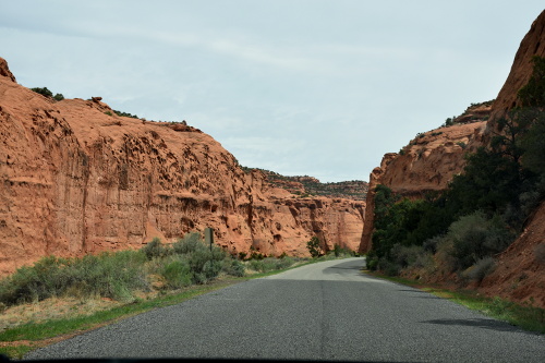
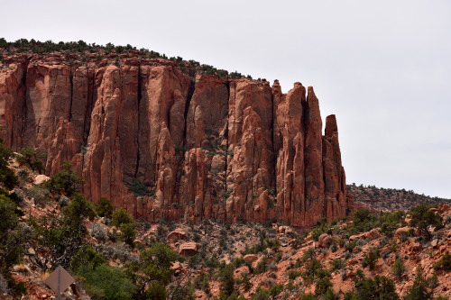
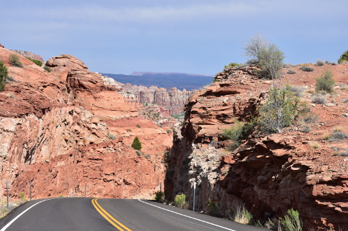
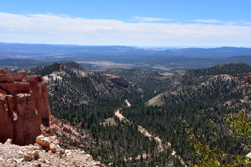
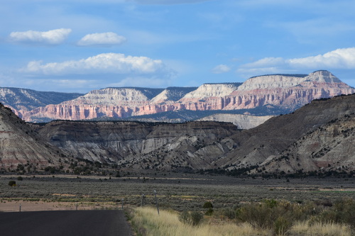
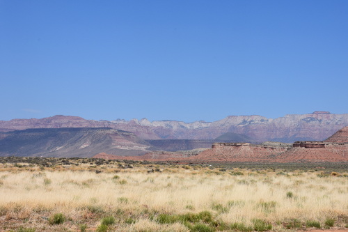
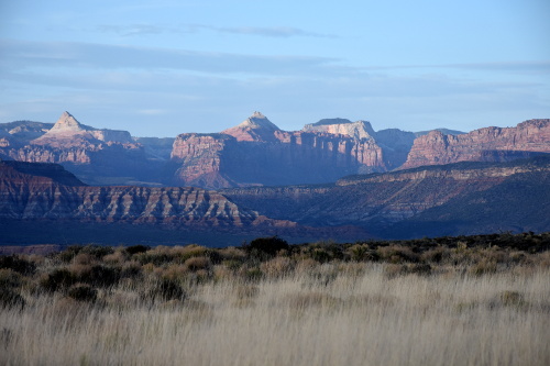
Highway 12, running along Escalante's northern rim, is considered one of the most scenic highways in the country, and reaches 9,600 ft above sea level south of Capitol Reef National Park. Only driving Highway 12 would make the trip worth it, it's that spectacular. It offers some of the most diverse and stunning scenery on the Colorado Plateau, linking Capitol Reef and Bryce Canyon National Parks.
05/04/18 Friday: Getting Started
Rather than getting up at 2:00 am Saturday morning to drive into Boston to catch our 6:30 am flight, we drove down to the Holiday Inn Express in Saugus, MA Friday afternoon.
Here's a Yelp! review I wrote for Holiday Inn Express in Saugus, MA:
Traffic was absolutely awful on Route 1, going both ways. It's always been busy, but it's been a long time since we have been down through there. What a mess. And of course, everyone drives like they want to die immediately, and so it's not a pleasant experience.
After getting checked in, we ventured back out into the craziness, and drove to The 99 Restaurant for an early dinner because we had to get up the next morning at 4:00 am. Our dinners were terrific, as they always are at The 99. Sue had a great Balsamic Chicken, and I had such a wonderful New Orleans Shrimp dish that I need to see if I can find a recipe to try to duplicate it!
You know, the more I settle into mountain life the less I care for any of the busyness of a city. The hotel is right on Route 1 so you could hear traffic all night. It's just not restful. It's utilitarian, but that's all it is....
05/05/18 Saturday: Salt Lake City and Salina
I had arranged to leave the car at the hotel while we were gone so that we could just take their 4:30 am shuttle into Logan. Not only was it dark, but the traffic had already started to mount up. I could hardly wait for the 20 minute ride to be over with! At least the turmoil in the terminal was more appealing than dealing with all that traffic mess.
I spent most of the 5.5 hour flight into Salt Lake City (elevation 4,226; population 186,000) reading William Least Heat-Moon's marvelous 1991 book, PrairyErth. Though at over 600 pages, I was able to finish it on the flight home. I found it to be one of my favorite books, and actually became inspired to read his Blue Highways as well. But that will be on some future trip, as these are the types of books that you just want to lose yourself in for hours and hours on a trip of your own.
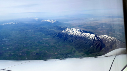
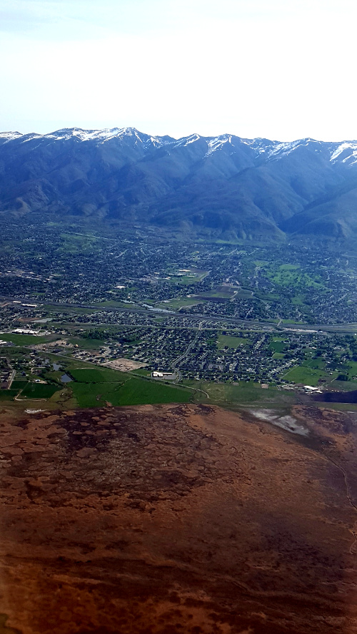
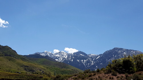
Flying into Salt Lake City is beautiful as it sits in a bowl surrounded by still snow capped mountains. The city itself is at an elevation of 4,226 with the mountains around 8,000 feet - highest point is Grandview Peak at 9,410 feet.
Spectacular views of the mountains surrounding Salt Lake City as we flew in.
Spectacular views of the mountains surrounding Salt Lake City as we flew in.
It took a long time at the Enterprise counter to get our rental car, a Chevy Cruze. By the time we got out of the airport and to a local IHOP for lunch, the temperature had gone into the high 80s. Though warm, there's only 4% humidity in general in Utah vs the 94% or so that we have back east. So, though it did get over 100 degrees many days, it wasn't debilitatingly hot. It was just hot.
Here's a Yelp! review I wrote for the IHOP in Salt Lake, but in general for all of them:
The Drive to Salina, UT
The target for today is Salina, UT (elevation 5,161; population 2,492) where we're staying for just one night. It's a couple of hours from Salt Lake City, and we figured after a tough start to the day with the flight it would be easier than trying to push through all the way to Boulder, some 5.5 hours or so away.
As we sat in the IHOP looking at a map, however, we thought that instead of driving straight through Provo, we'd like to jump over to see Park City. Well, Park City is 'nice', but nothing that we'd want to come back to. We scooted out of there onto I-189 south and headed for Provo.
View on the way to Park City.
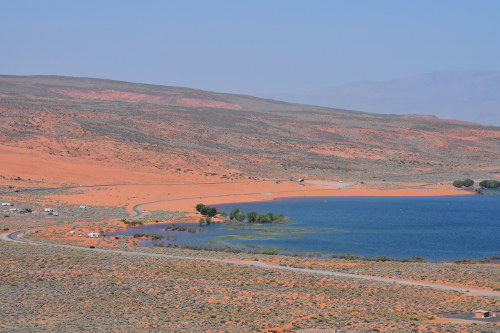
On the way, Sue wanted to stop at the Deer Creek Reservoir in Heber Valley. It's a beautiful 2,965 surface-acre reservoir stocked with rainbow and brown trout, perch, walleye, and small mouth bass. We paid a few dollars entrance fee as there's also a very pretty waterfall cascading down the mountain face that you can hike to.
We really liked Provo. Beautiful town with spectacular views all around. Though it's population at 115,000 is almost that of the 186,000 in Salt Lake City, Provo just seemed to be so much calmer than Salt Lake. Neither of us would care to go back to Salt Lake, but we might Provo, though it's a big college town and those aren't of much interest to us in that regard.
It was a very pretty ride from Provo to Salina, particularly since we didn't take I-15. I-15 is pretty, but barreling along at 65 mph when you can drift through the back roads and see the sights is so much more fun. We took 89, 6 and 10 down through Whipup into Salina, where we rose to 5,100 feet.
We pulled into our hotel, the Rodeway Inn, where we'd spend the night before pushing on to Torrey in the morning. The Rodeway was very cute and very clean; we'd stay there anytime
Here's a Yelp! review I wrote for the Rodeway Inn:
For dinner, the Rodeway desk clerk highly recommended the El Mexicano Restaurant just across the road. Good recommendation!
Here's a Yelp! review I wrote for the El Mexicano Restaurant:
After dinner, Sue wanted to take a drive around the small town of Salina and into the back roads as the sun was just beginning to drop toward the mountain horizon.
05/06/18 Sunday: Boulder, UT
We left the Rodeway Inn about 8:00 am Sunday morning, taking I-80 West to Route 24 South into Torrey, UT (elevation 6,837; population 180) to meet up with Lucas and Jill for a late breakfast at 10:30 at the Capitol Reef Inn. It was a beautiful drive; 24 is really pretty.
Lucas' parked his car at the Torrey Visitor Center, and he and Jill jumped in with us. Sue had bought an annual Senior National Park Pass which gives everyone in the car access to every national park in the country for a year; a terrific deal as most of the national parks charge $30 per vehicle.
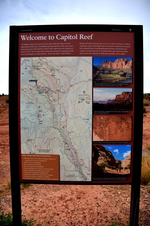
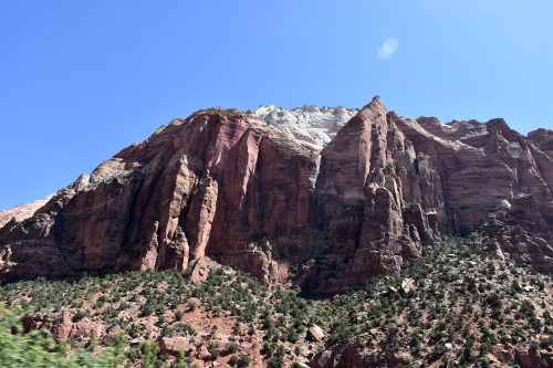
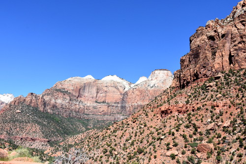
Capitol Reef National Park
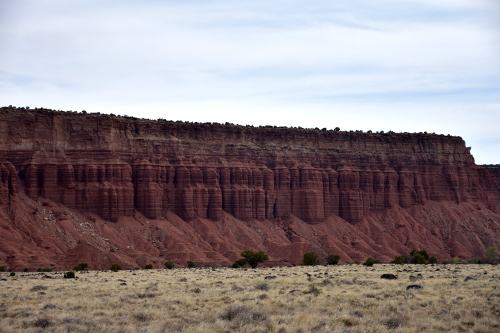
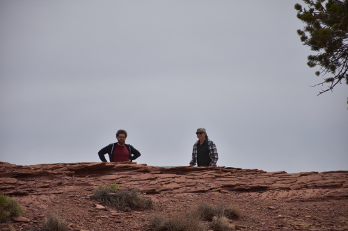
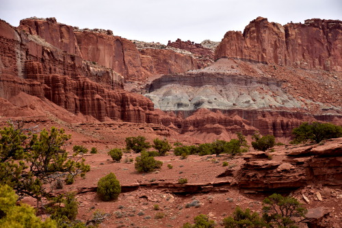
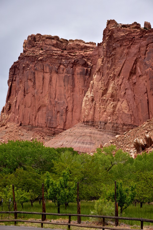
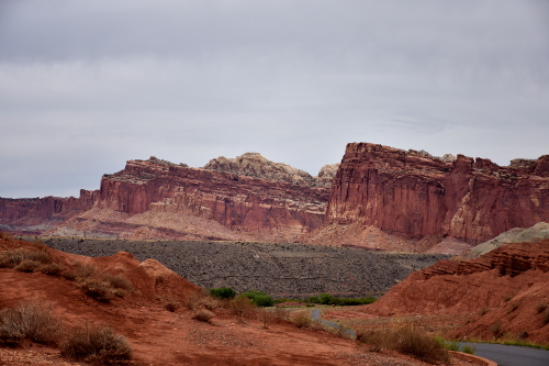
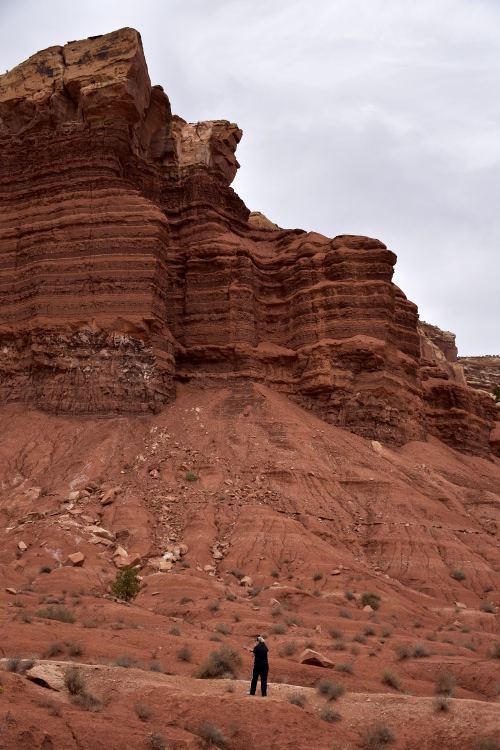
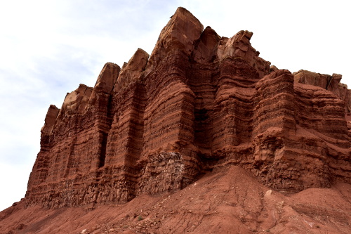
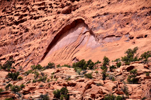
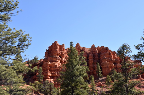
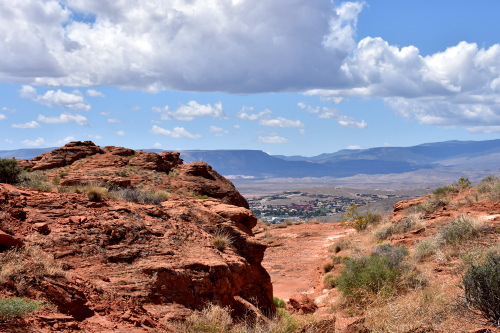
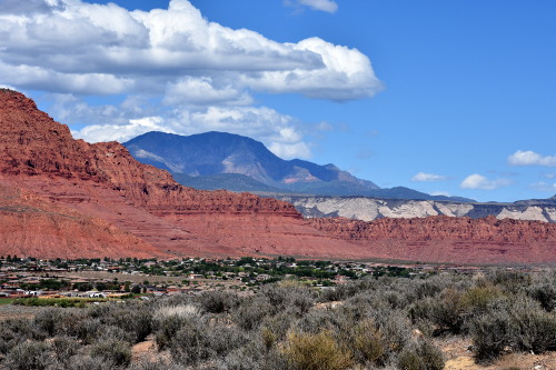
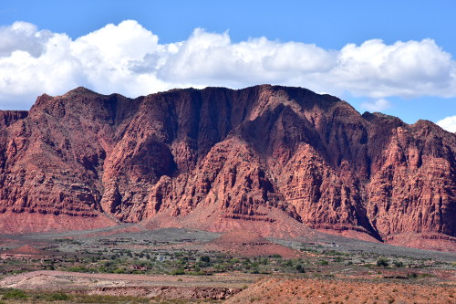
We drove over to the Capitol Reef National Park which is in Utah's south-central desert. It surrounds a long wrinkle in the earth known as the Waterpocket Fold, with layers of golden sandstone, canyons and striking rock formations. It is so beautiful, it just takes your breath away. Capitol Reef stretches across the Colorado Plateau for 150 miles and rises straight up out of the earth for hundreds of feet, exposing the most beautiful shades of rust colored sandstone.
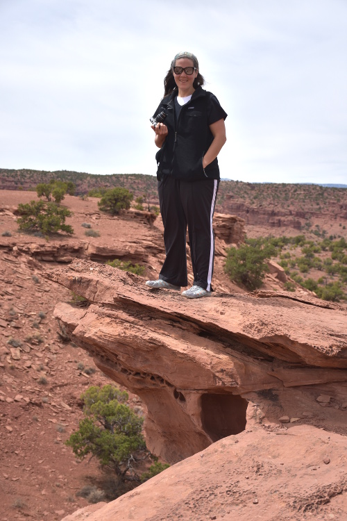
Jill being far more brave than me!
Lucas and me coming over the ridge.
Spectacular colors
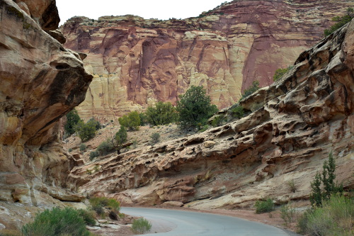
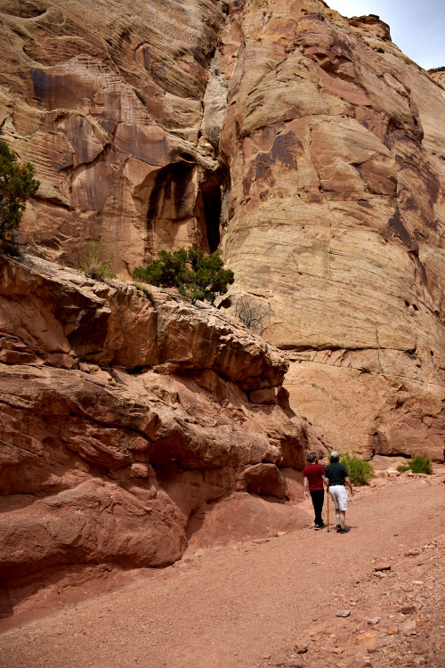
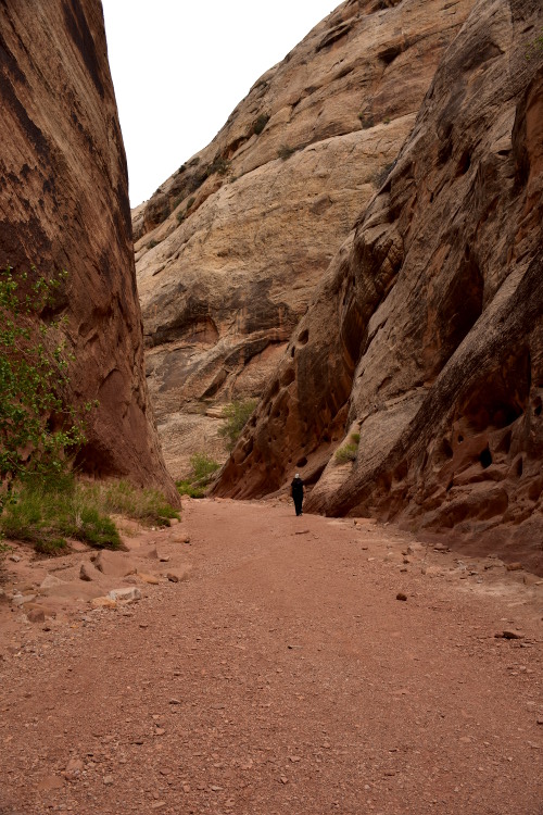
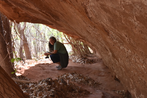
We drove the 11 miles through the original Pilgrim settlement, where we stopped for ice cream, and then down to what's called Capitol Gorge. The last 3.5 miles was dirt and gravel, but the views were so magnificent that you just can't believe it. We all hiked in on the trail for about a mile before I turned back; they all wanted to climb up a steep incline to the top of one of the cliffs of the slot canyon we were in.
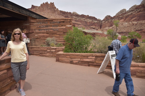
Sue in front of the visitor center before heading down to The Gorge.
Jill gives some perspective to the scope of the rock formations.
As I was walking back over the rocky dry creek bed of the canyon, I could well understand all of the warnings posted about getting out at the slightest hint of rain. Flash floods are a huge danger, and not to be taken lightly. I've seen pictures in some of the visitor centers of the parks showing cars totally destroyed after being caught. Not to mess with....
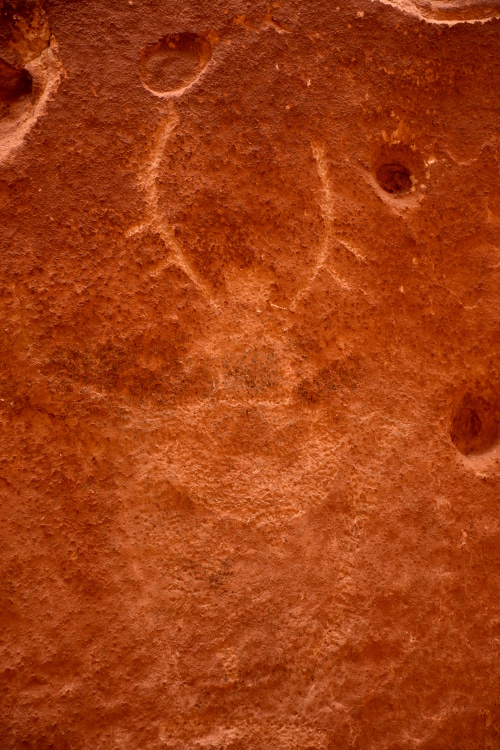
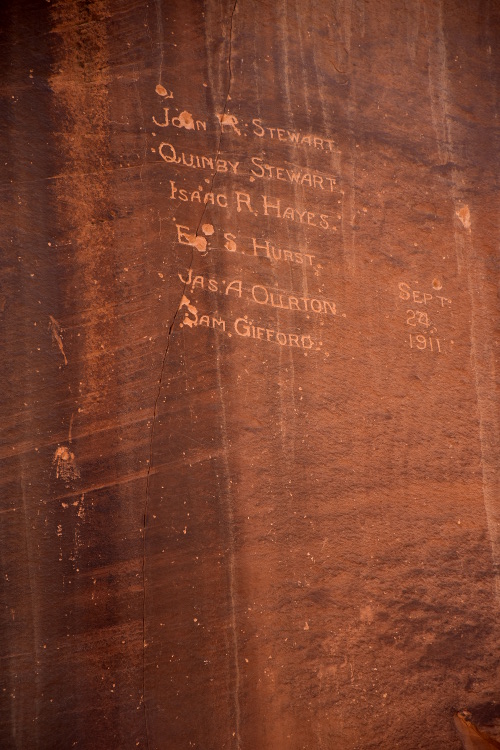
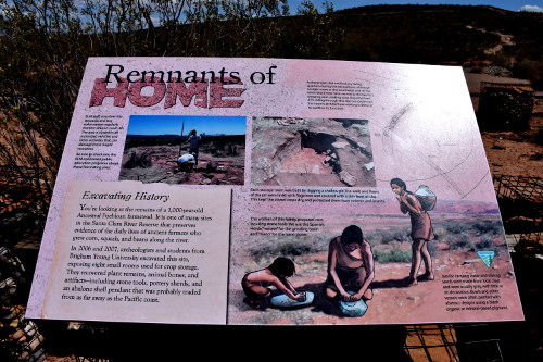
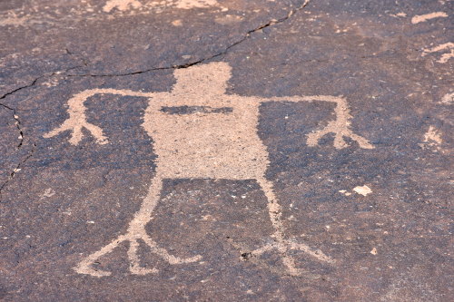
Petroglyph panels throughout the park depict ancient art and stories of these people who lived in the area from approximately 300-1300 common era (CE).
Mormon pioneers took eight days in 1884 to clear the first road through the Gorge, and settlers had to remove heavy debris after every flash flood. Early travelers recorded their passage on the canyon walls at the Pioneer Register.
Lucas and me in the gorge
Jill way ahead in the gorge
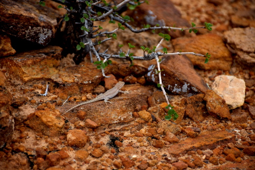
A salamander checked us out.
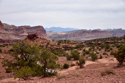
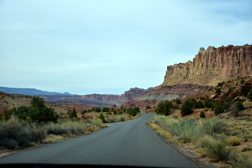
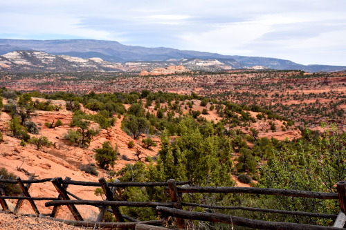
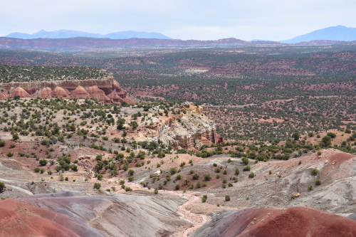
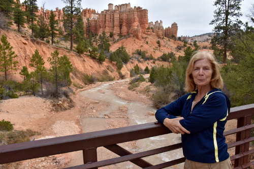
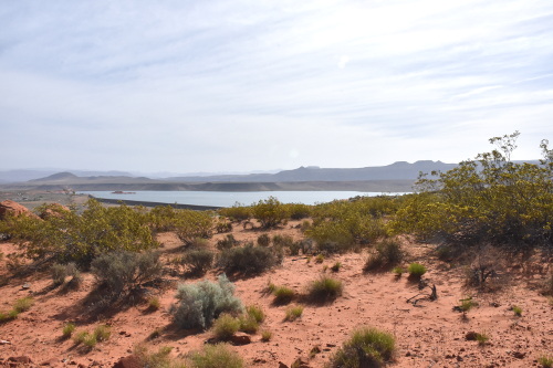
The whole landscape changes once you head out of the park. It's amazing. Sue took the following pictures on the drive from Capitol Reef down to Boulder.
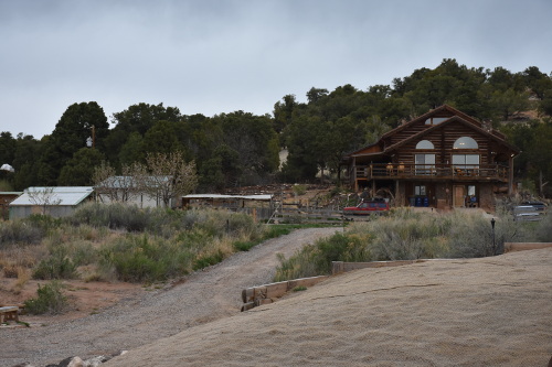
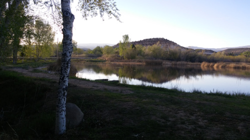
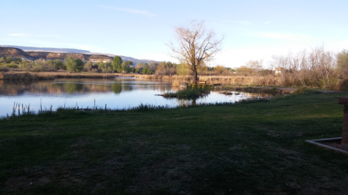
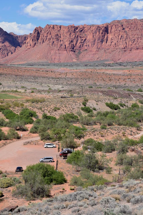
Boulder Mountain Guest Ranch
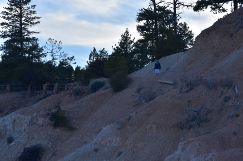
We left Capitol Reef National Park at 4:00 pm for what was supposed to be a 1 hour drive down Highway 12 to the Boulder Mountain Guest Ranch, which is just past the little village of Boulder, UT (elevation 6,703; population 220). Though the maps show speed limits of 50 mph, you're lucky to get 20 mph over the many switch-backs encountered as well as way too many calls for, "Pull over!" photo ops at the terrific scenic viewing areas we stopped at. Great stuff, but it took us almost 2 hours to get to the guest ranch!
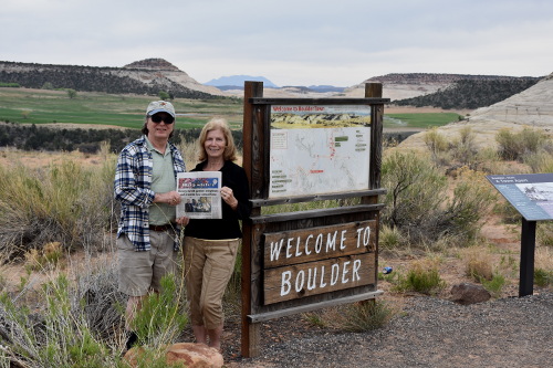
Jill took this picture of Sue and I holding up a copy of our local Baysider newspaper. When we get back, we'll send it in and they'll publish it!
You just don't go fast on these mountain roads: during the Civilian Conservation Corps building of the Hell's Backbone Road (where the Boulder Mountain Guest Ranch is located) the road construction workers referred to it as The Poison Road because, "One drop and your dead." How charming....
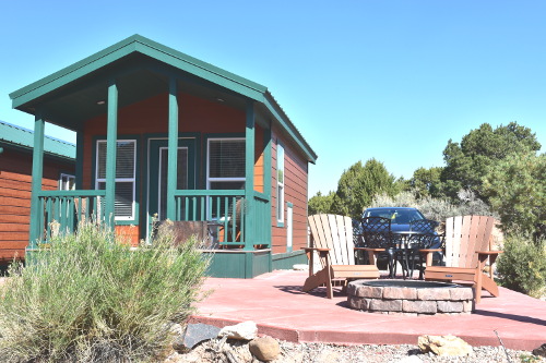
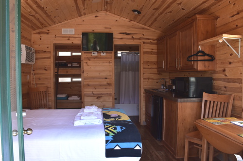
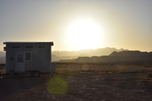
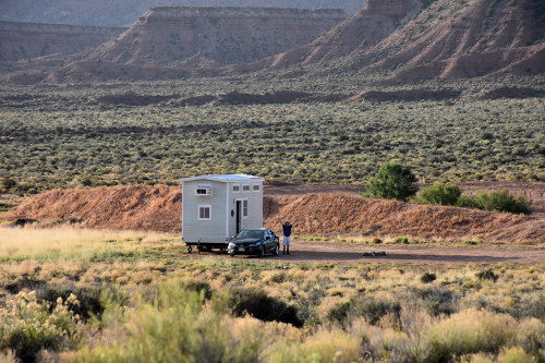
The ranch itself has many stand alone cabins, as well as some rooms in the lodge, and a couple of Indian teepees. We had one of the cabins, and it was beautiful - all wood with beautiful exposed beams, and very cutely decorated with a full kitchen and wonderfully relaxing shower.
You don't want to miss this sign or you'll be in tough shape on Hell's Backbone Road which not far beyond here becomes very narrow and gravel.
Boulder Mountain Guest Ranch main lodge.
Our cabin.
All in the middle of nowhere, perched on Hell's Backbone Road. It didn't get any better than this for our entire trip. I'd stay here again in a heart beat. The only negative is that you can only get internet connectivity in the main lodge, and the signal is so weak that you're lucky to just be able to do some email scanning before you tire of the effort. And there's no cell service. You're nowhere, so enjoy it while it lasts!
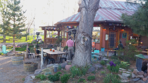
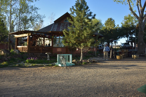
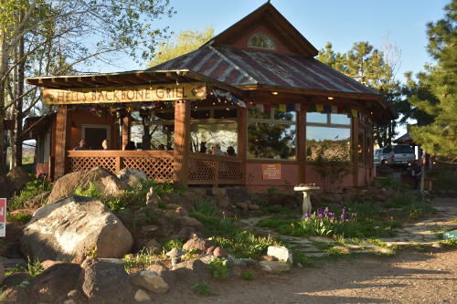
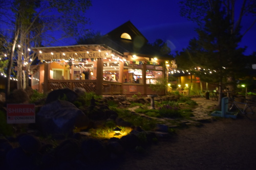
Hell's Backbone Grill
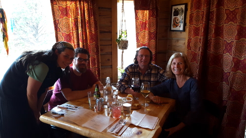
Because of the unexpected time it took to get to the ranch and checked in, it didn't give us much time to clean up and get ready to head out for our 7:30 pm dinner reservations at the Hell's Backbone Grill. But that experience was everything I had hoped it would be.
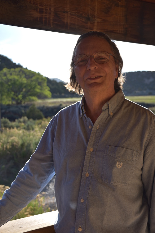
I'm ready to head out!
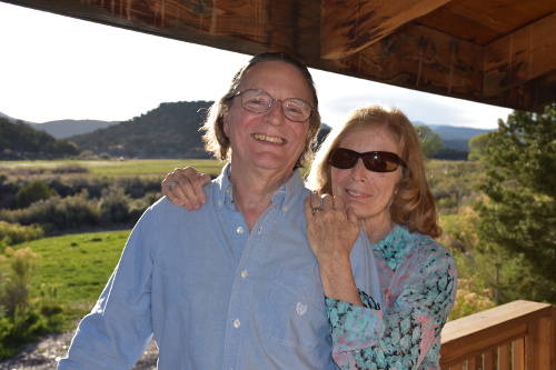
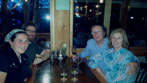
And to share the night and my Bucket List dream with Sue was just wonderful.
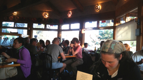
The atmosphere is wonderful, and the food top notch. I totally enjoyed one of the best meat loafs I've ever had. Sue had scrumptious Pork Stuffed Peppers, and Sue's kids who joined us for dinner, were more than pleased with their selections. There's a great wine selection that we took advantage of, and so enjoyed ourselves. For me, it was magic, number 1 bucket list item checked off, and I'll never forget it.
Behind HBG to the left.
Behind HBG to the right.
Lucas sitting outside jusst off to the right as we wait for a table to clear.
Shot of me waiting to go in for dinner.
A little different view
Jill checking out the menu; it's a full house!
It couldn't get any better than this!
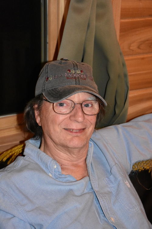
I'm all set with my new Hell's Backbone Grill ball cap!
Though a little blurry, Sue got this great shot of the restaurant as we were leaving.
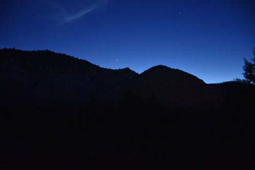
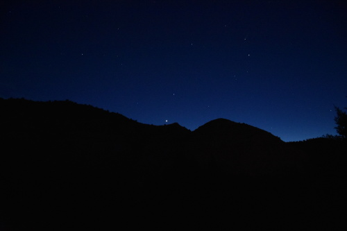
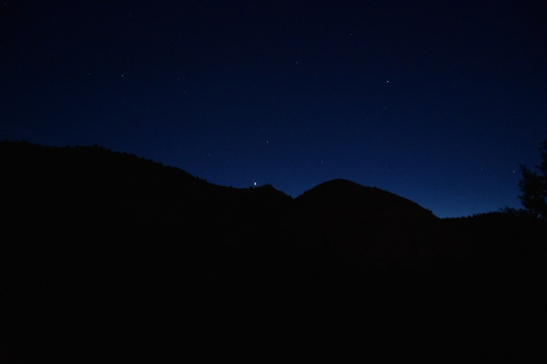
When we got back to the guest ranch, after picking our way so very carefully along Hell's Backbone Road in the dark, Sue and Jill took a walk outside. There was supposed to be a meteor shower, and off they went into the pitch black of the night.
I went out for awhile as well to look at the night sky. There are no city lights bleeding into the darkness, and I could see literally millions of stars dotting the entire black canvas above me. The word impressive doesn't do the experience justice....
05/07/18 Monday: The Burr Trail
We were all up at 7:00 am, took showers, and had much needed coffee with breakfast at the guest ranch's Sweetwater Kitchen in the main lodge.
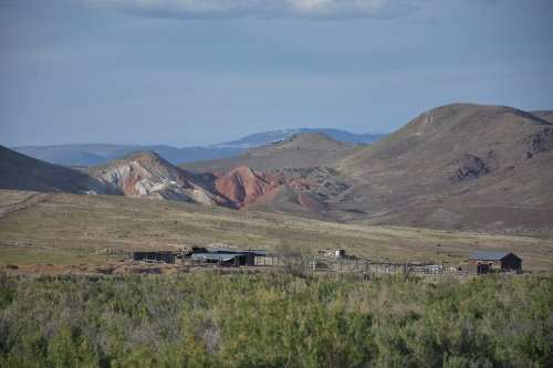
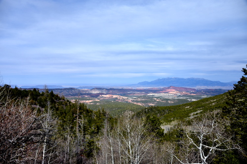
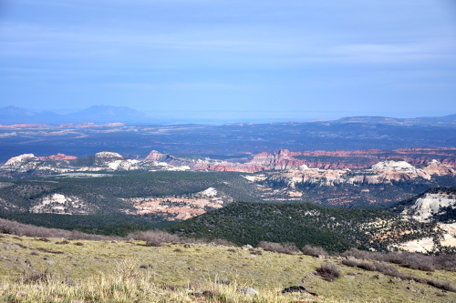
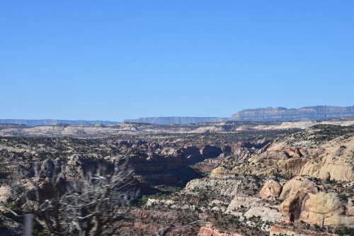
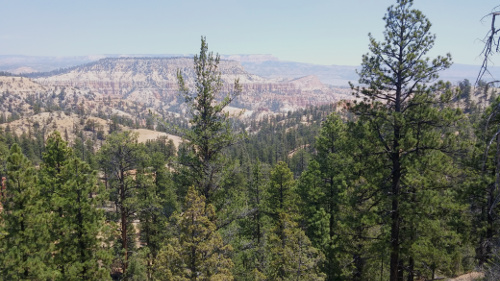
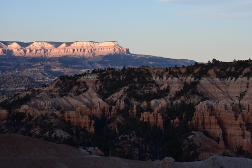
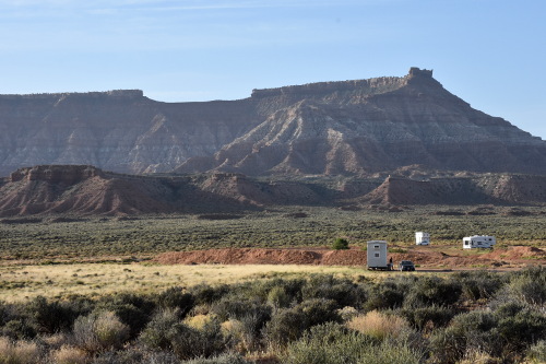
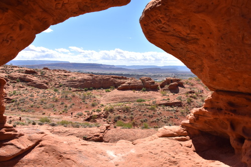
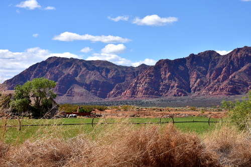
We were soon off for a day of exploring. On the plan was: The Burr Trail, Long Canyon, Lower Gulch Trail, visiting the towns of Boulder and Escalante, and just taking in as much of the grandeur of this area of the Grand Staircase-Escalante National Monument, a United States national monument that originally designated 1,880,461 acres of protected land in southern Utah in 1996.
The Burr Trail
The West side of The Burr Trail actually begins right at Hell's Backbone Grill. We stopped to get coffee at the cute Burr Trail Trading Post before rolling onto the access road. What was originally developed as a cattle trail blazed by stockman John Atlantic Burr, the Burr Trail Scenic Backway is now one of the most picturesque drives in Utah. A paved and graded, gravel and dirt road, it extends from Boulder to Bullfrog Marina, passing through the Grand Staircase-Escalante National Monument, Capitol Reef National Park, and Glen Canyon National Recreation Area.
The start of the Burr Trail is next to the Hell's Backbone Grill!
After driving about 15 miles, the road descended very steeply across steering wheel, death grip, switch-backs into Capitol Reef National Park's Long Canyon. Shear face rust sandstone canyon walls rose hundreds of feet above us on each side of the narrow road.
Taken off the switch back descending into the road running through Long Canyon, which you can see winding through rock cliffs. This is actually the point in the road that we returned to later called the Lower Gulch Trailhead.
Driving through Long Canyon.
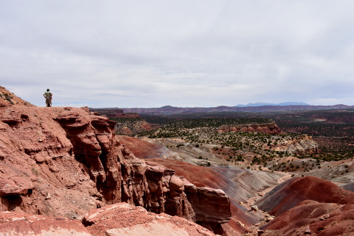
And then, after another 20 miles or so through Long Canyon, the road began to climb to a summit where a spectacular vista spread out before us, an enormous desert valley stretching out to Capitol Reef in the far distance.
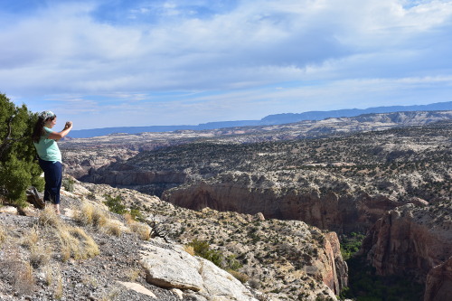
We pulled into a parking area by an iron fence gate that could be closed across the road to block traffic in bad weather. When we started to walk around, we were just amazed at how expansive the view was! You simply can not describe it, and pictures can't either.
To me, this was one of the best experiences of the whole trip. Unfortunately, pictures, no matter how good, simply can not capture the grandeur of the Nature we saw. It was, to put it mildly, just breath taking.
One of my few adventures out to a cliff edge. I discovered I have a great aversion to such exposure....
Me taking a picture of Sue taking a picture!
We continued on down into the valley for another 10 miles or so before turning back. We had read about a Lower Gulch Trailhead, and thought we had seen a pull off for it about half way down the switch-backs into Long Canyon. So, back through the magnificent Long Canyon we went, loving every minute of it!
Just as I had remembered, after winding our way about half way up the narrow switch back road we saw the small trailhead access road. I pulled into the soft, red, granular sandstone area, but didn't continue down the road as it looked pretty rugged.
We got out of the car and walked back over the deeply rutted and protruding rocks covered road to a rocky parking area. I didn't as the road had deep ruts, and protruding rocks. Good thing I drive down there as I'm sure the car would have bottomed out.
Though it was 106 degrees, everyone wanted to slide down the side of the cliff on the narrow hiking trail just off the parking area and check things out. I had no interest in that and wished them well.
If you look very closely, you can just see Sue, Jill, and Lucas at the top middle of the picture. They were way down there!
After watching them disappear down the trail, I went back to the car to read from PrairyErth. I did flag down a couple who pulled up next to me and mentioned how bad the road was. They were very grateful for the warning, and opted to turn around.
Man, it was hot! I can't imagine struggling across that trail, but when the troops finally returned in about an hour they were pretty cheerful about their adventure.
It was good to get the car moving! I had been sitting in that heat with the windows open the whole time they were gone. It wasn't too bad because of the low humidity and a nice breeze that blew all the time. But the sun itself was really hot.
Escalante, UT
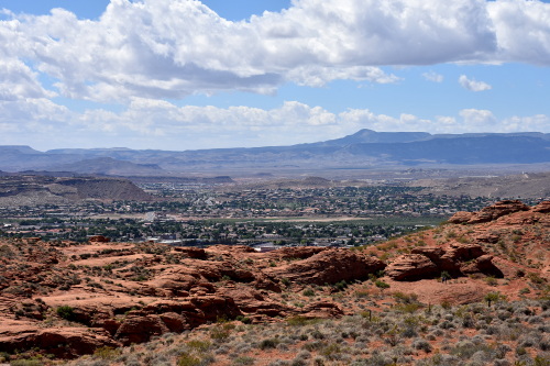
After the Burr Trail, we had planned on checking out Boulder, and then driving down to see the town of Escalante, UT (elevation 5,820; population 797). Well, there really isn't much to Boulder itself, so we headed off south on Highway 12 for Escalante.
And this is the part of Highway 12 that has The Hogsback (elevation x): "...a portion of Highway 12 that travels over the narrow spine of a mesa with canyons on either side created by Boulder Creek and the other side is Calf Creek. Many years ago the road was one lane and traffic could only cross in one direction, but it has been widened to standard highway width and provides some of the most stunning views to be had on Highway 12."
As I mentioned before, there were few views that I could enjoy due to the white-knuckle sides of the road falling away for over a thousand feet on both sides! Not only did I have to do that going into Escalante, but also coming back to Boulder. Terrific... but absolutely not to be missed for the views and the experience. I should get a ball cap made up with, "I lived crossing The Hogsback!" on it...
Escalante itself is a small but cute town with Highway 12 running right through its center. We drove to the south end of town to the Grand Staircase-Escalante National Monument Visitor Center for some information on Bryce Canyon that we were heading to the next morning. Before heading back to Boulder Mountain Ranch (which is actually in Escalante, but just on the northern boarder to Boulder) we drove out to see the Escalante Petrified Forest State Park. It was only a few dollars entrance fee, but worth it to see this huge petrified tree that they had found and moved to a raised concrete platform for display.
Dinner at the ranch's Sweetwater Cafe
After returning over the Hogsback to our cabin, we got cleaned up, and went to dinner at the ranch's Sweetwater Cafe. Brie was a wonderful server, and made great suggestions about the evening's menu.
Dinner at the ranch's Sweetwater Cafe
I had the Bacon Carbonara, but unfortunately, I wasn't a real fan. Not only wasn't it anything like a Carbonara that I had ever had or made, but the bacon was a little burnt, and that overpowered the rest of the dish, though nothing on the plate really had much taste to it anyway. Probably just a one-off because everyone else's meals were really good.
Sue had a really nicely spiced Golden Beet Salad with a Trout Taco. Lucas enjoyed a Bacon Burger that was really done well; in fact it was outstanding. And Jill really liked her Squash Taco. As a suggestion, there is a need for more selections on the menu.
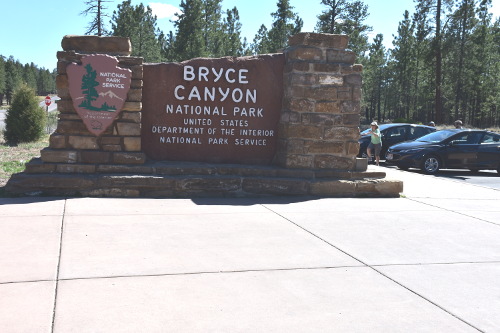
05/08/18 Tuesday: Bryce Canyon National Park
After breakfast at 7:30 am at the Boulder Mountain Ranch, we headed for Bryce Canyon National Park. Of course, that was one more trip across the Hogsback, but I was getting pretty good at it by this time and was able to enjoy the views more. We stopped in Escalante at a Subway for coffee, and to buy subs for lunch later.
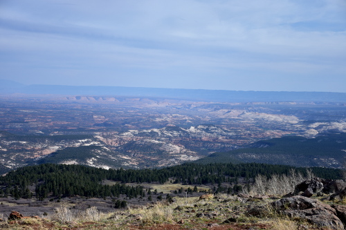
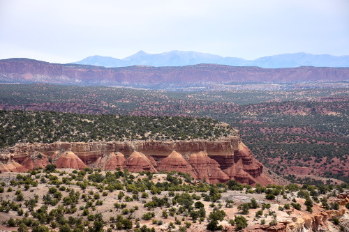
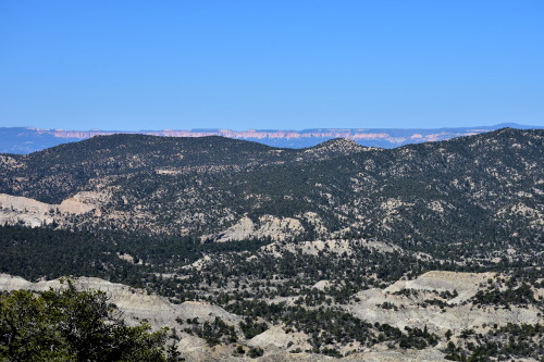
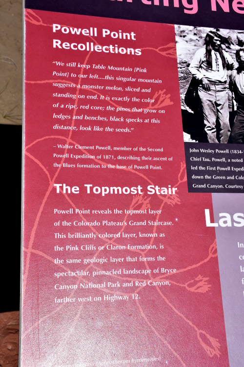
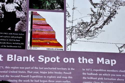
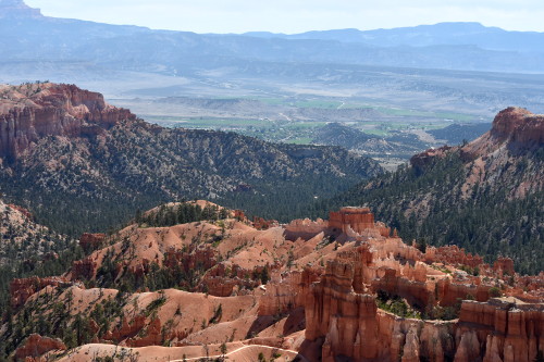
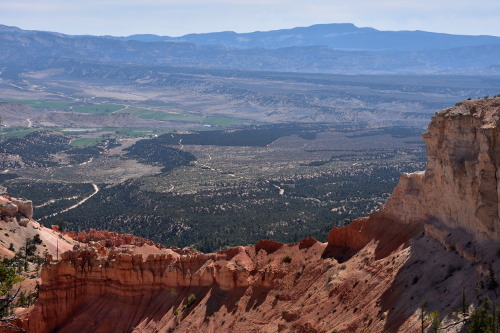
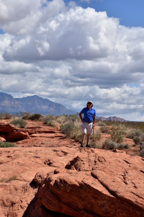
Driving south after Escalante was much smoother because we were in deep valleys most of the way. However, that didn't mean there were no mountains to navigate. At one point as we crested a steep hill there was a large parking area that we pulled off into. It overlooked a huge basin area that was mapped by John Wesley Powell.
In 1872, Powell launched his second expedition down the Green and Colorado Rivers to chart the Rivers and surrounding lands, including Boulder Mountain and the rest of the Aquarius Plateau. The expedition also named and mapped the Escalante River and the Henry Mountains, respectively the last-mapped river and mountain range in the lower 48 states.
The area had previously appeared on maps as just blank white space. There is a high plateau you can see across the way that Powell was said to have climbed to get the full view of the area. I can't imagine how tough that climb was. An interesting stop; glad Lucas, who was in the lead vehicle, saw it and decided to pull in.
Highway 12 descends into Bryce Valley and the town of Tropic, UT (elevation 6,309; population x), named by settlers in 1892 for its seemingly mild, but arid climate. Despite the lack of constant local rainfall, a cloudburst on a dirt road in this country can strand the beefiest four-wheel-drive vehicle in a slimy mess. Locals say, "All you have to do is spit on the road, and you'll get stuck"
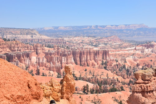
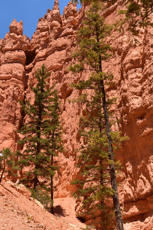
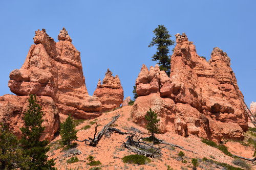
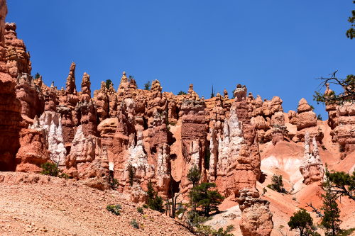
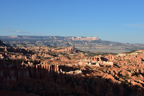
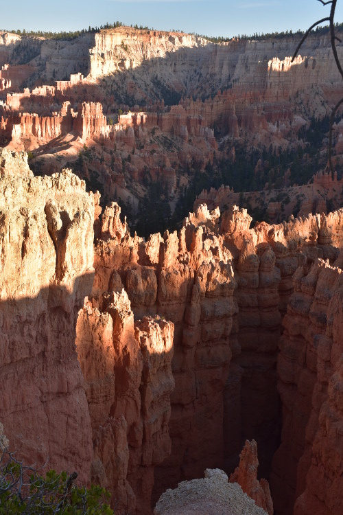
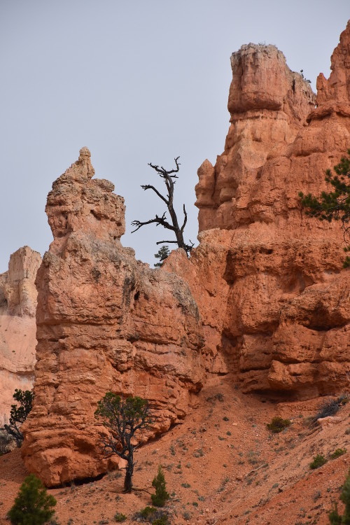
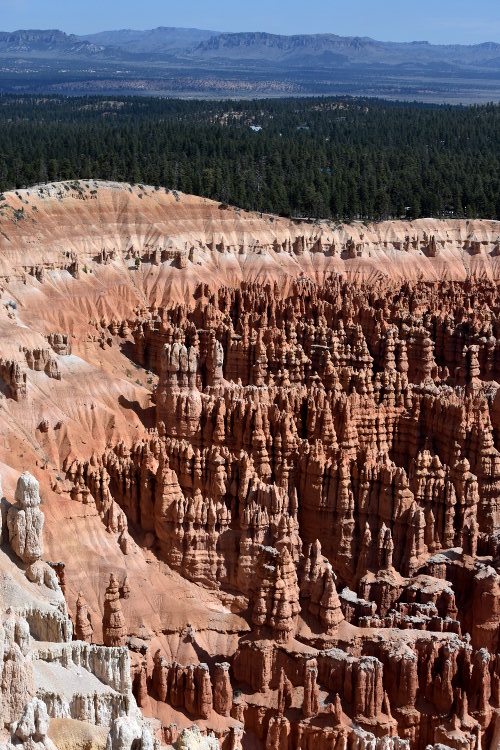
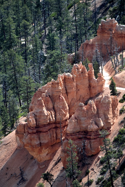
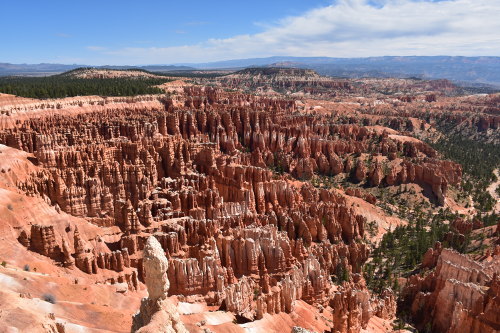
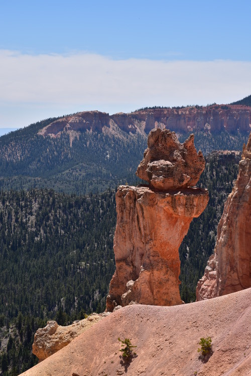
Bryce Canyon
The Bryce Canyon National Park got its name from Ebenezer Bryce who constructed a logging road in the Bryce Amphitheater, and the local commonly referred to this road as "Bryce's Canyon". Bryce reportedly described his canyon as "...a hell of a place to lose a cow."
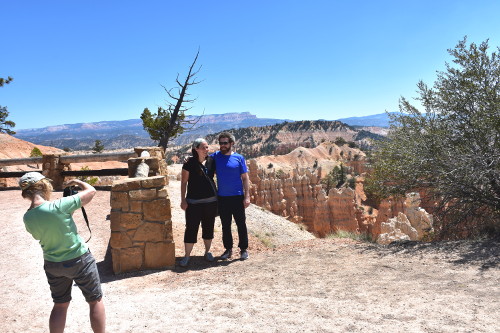
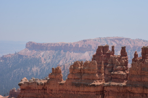
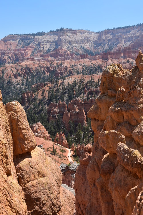
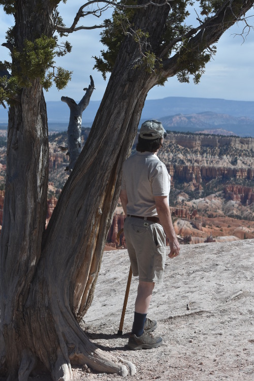
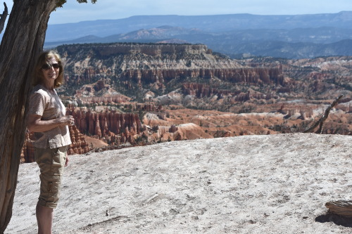
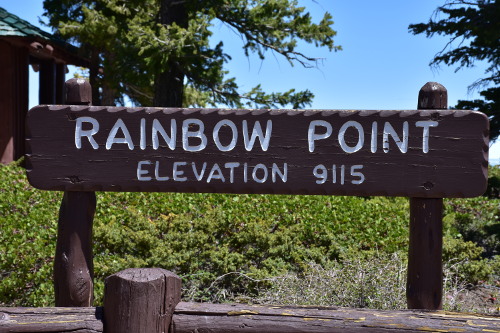
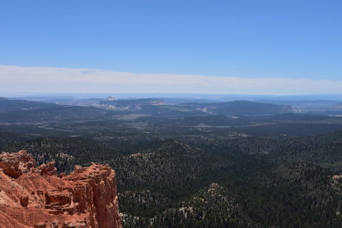
We arrived at the Bryce Canyon Fairyland Point about noon. You can go out to this point before hitting the entrance gate for the park where you have to pay. The views are beautiful, and every bit as spectacular as most all of the observation points in the park, other than the far (18 miles in) Rainbow Point that you just can't imagine the views.
Me taking a picture of Sue taking a picture!
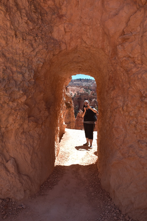
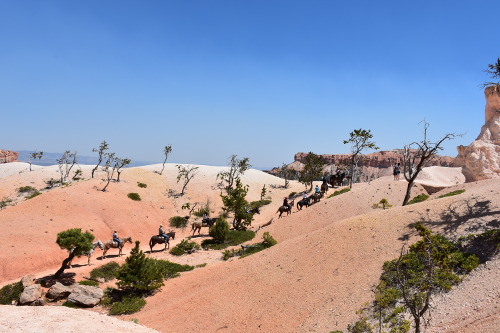
We then went to the Bryce Canyon Visitor Center, and wandered through there for awhile as it was really interesting. The crew wanted to hike down into the canyon, but I just am not a "hike down into the canyon in 90 degree temps" type of person.
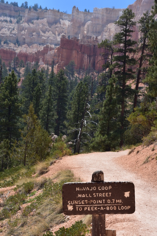
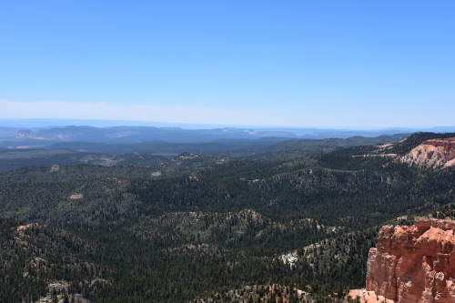
I dropped everyone at Sunset Point where they got on the trail, and then drove to a shaded area at Sunrise Point to wait for them. I got out of the car and walked up to the canyon's Rim Trail, which hugs the side of the canyon wall from Fairyland Point all the way out to some of the further points.
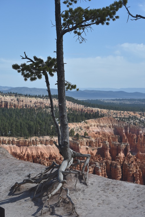
The Rim trail close to Sunrise Point.
The Rim trail close to Sunrise Point.
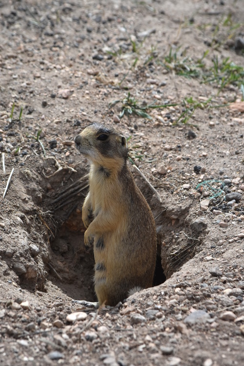
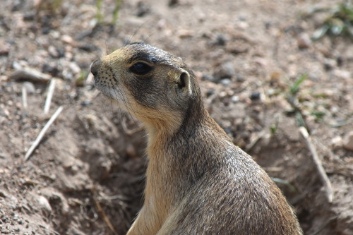
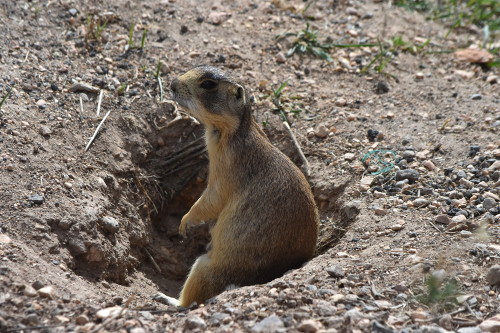
Before going to Sunrise Point, however, I did make one small stop. On the way to dropping the crew off at Sunset Point I had noticed a gravel road with a line of cars along a post and wire fence. I thought I check that out, and I'm glad that I did. Though the gravel road is closed to general traffic, it runs along this high desert pasture that is a protected prairie dog habitat. How cool was that!
Sue took this picture, and a couple others, the next day of this prairie dog peeking out of his home.
Of anything on the trip that I saw, the views along this Rim Trail from Sunrise Point to Sunset Point was absolutely the best and worth the price of the trip itself. Wow! But it was really hot, in the 90s, and, even low humidity, I was roasting. I went back to the car, opened the windows to let the constant breeze blow through, and read for about 2 hours until the crew climbed up out of the canyon around 3:00 pm.
Sue took this and the following pictures as she and her kids walked one of the loop trails way down into the canyon from Sunset Point over and back up to Sunrise Point where I was waiting for them.
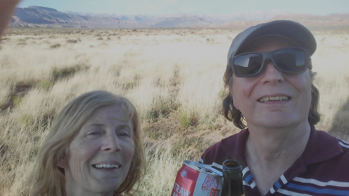
When they met me in the parking lot at Sunrise Point, we all went over to the Sunrise Point Store, got ice cream, and sat outside on one of the park benches to chat. We drove Lucas and Jill back to where they had left their car outside of the park - so they could get in on our pass. Hugs and kisses, and off they drove at 4:00 pm headed for St. George for the night. Lucas would then take Jill to the airport to fly back home, and he'd continue on to L.A. in his car.
Sue wishing Lucas and Jill off from where Lucas had left his car.
Though sad to see them leave, it was so wonderful of them to have come out to participate in my Bucket List Dinner at Hell's Backbone Grill, celebrate an early Mother's Day with Sue, and share all the things that we saw and did in the last couple of days.
K.O.A. Is Just OK....
Sue and I left the park then as well and drove back up Highway 12 about a half hour to a K.O.A. in Cannonville (elevation 5,886; population 167) where Sue had made reservations for us to stay.
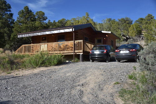
The outside of our cabin at K.O.A.
Inside our cabin at K.O.A.
The K.O.A. is nice if you're into RVing or camping. But there were some things about our experience that we just didn't care for. Okay, so the assumption of K.O.A. is that you pull up in your rig, and all you need to do is hook up to their systems. Our expectation in renting a separate cabin, a Delux cabin, is that it would have more than 4 coffee cups and a coffee maker with 2 packets of free coffee.
There were no utensils - not even a spoon to stir the coffee. No plates, bowls, or glasses. Nothing. And their WiFi totally sucked. Here you have this beautiful cabin, so nicely decorated, and with terrific views of the mountains in the distance, but no ability to fix any food.
It really hit a negative chord in us. We're not spoiled city folk expecting high class accommodations. but it just seemed as though no one in K.O.A. gets it that if you rent a cabin you don't have anything like the RV folks do. So, we paid a pretty good price for what we felt was an under serviced cabin. We won't stay at K.O.A. again, but that's just us as I'm sure - from all the great reviews K.O.A. gets - that it's a terrific experience if you're RVing or camping out.
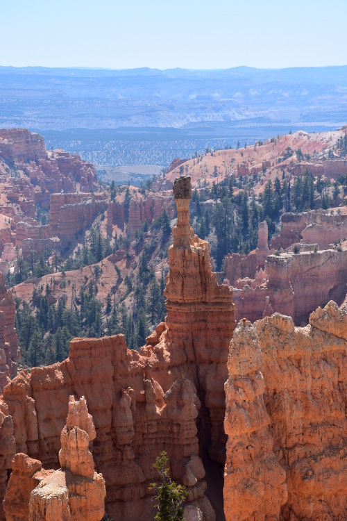
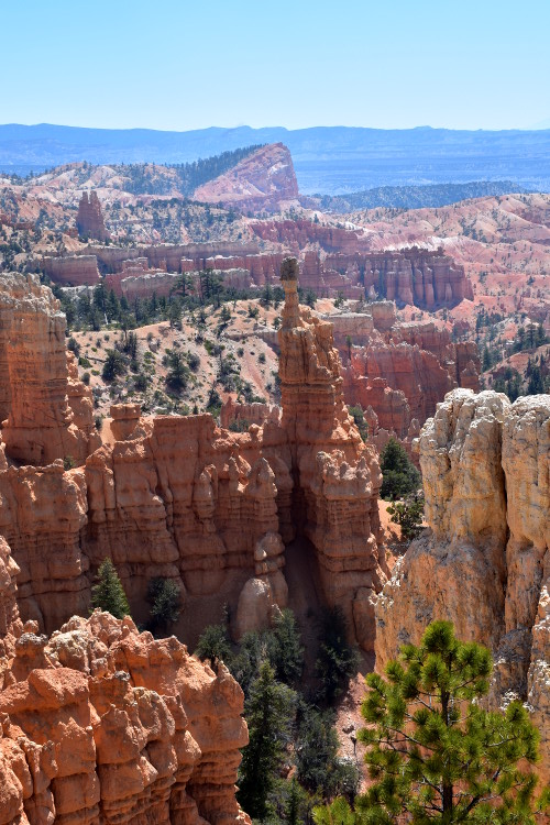
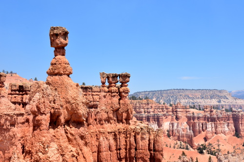
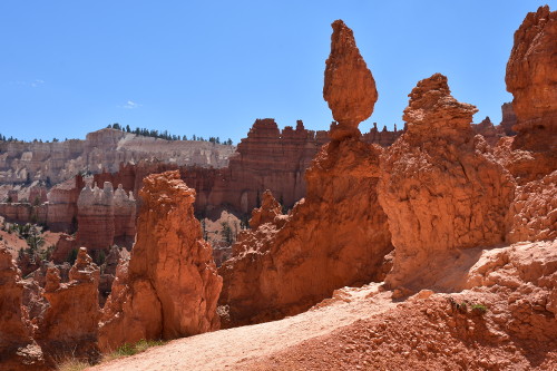
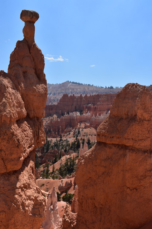
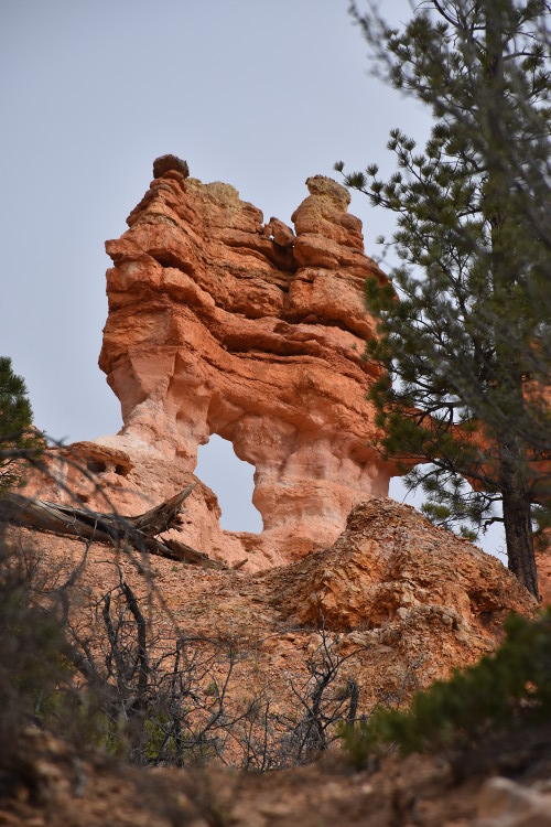
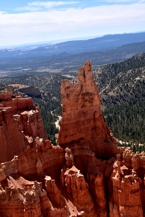
While sitting there finishing up our pizza, I suggested to Sue that if we hurried we might be able to get some great sunset pictures back at Bryce. We dashed to Fairyland Point, and caught the sun just as it was cresting down over Thor's Hammer, one of the most incredible hoodoos imaginable.
Thor's Hammer
I was not a fan of the narrow trail with the really, really steep drop off, so I stayed back as Sue went out to the point to get a few pictures as the sun rapidly dropped behind the cliffs.
We took quick showers, and headed off into the nice town of Tropic, just up the road back toward Bryce about 10 minutes. We had spotted The Pizza Place restaurant on the way in, and thought it would be great to have some pizza and a beer. Okay, so we ate bland pizza and listened to honky-tonk country music. The music is fine, but no excuse for crappy pizza.
05/09/18 Wednesday: Back for another day at Bryce Canyon!
We were up at 7:15, and after stopping for a bite to eat and coffee, we headed back to Bryce.
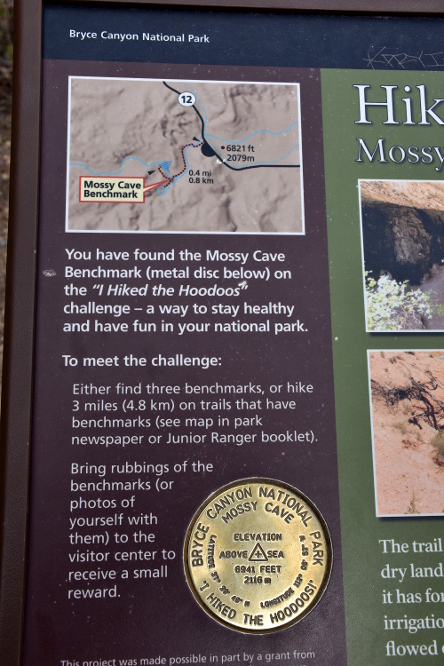
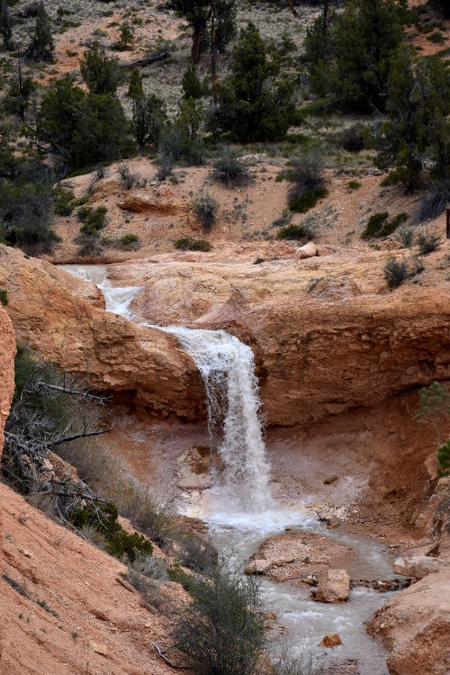
Mossy Cave Trail
On the way, we pulled over at the Mossy Cave Trail. I hadn't seen it the day before because there was no where to park, but Sue and the kids had, and they loved it. So, I wanted to have a look. Fortunately, there was plenty of parking when we got there - but it was jammed and a mess by the time we left.
The place is not only beautiful with its myriad of hoodoos and sparkling waterfall, but it has a really interesting history. From 1890-1892 Mormon pioneers labored with picks and shovels for 3 years to carve an irrigation ditch 15 miles from the East Fork of the Sevier River, through the Paunsaugunt Plateau, into this canyon. I just can't imagine the effort it must have taken to dig that channel; it's amazing to see.
The trail itself isn't long, only about a half mile loop, but there is so much to see. Sue and I climbed all over the place up around the waterfall. The water just gushed around the sharp rock canyon walls and down over the rim of the falls. There are a couple of bridges across the water with great views of the area. Great picture taking for Sue, and I really enjoyed experiencing it all with her.
Picture stop for prairie dogs
When I told Sue about the protected prairie dog habitat I had seen the day before, she was all fired up and wanted to check it out. She got some terrific pictures of a couple of the prairie dogs with her camera that just can't be beat. Those dogs are something else.
There's a neat exhibit at the Visitor Center where you push buttons and hear different levels of warning barks of prairie dogs. There's one that is just a few quick chirps, and then one that's a series of close, high pitched barks indicating close danger. We heard all that as we leaned against the fence, so it was pretty neat. Neither of us had ever seen a prairie dog before, so this was quite a treat!
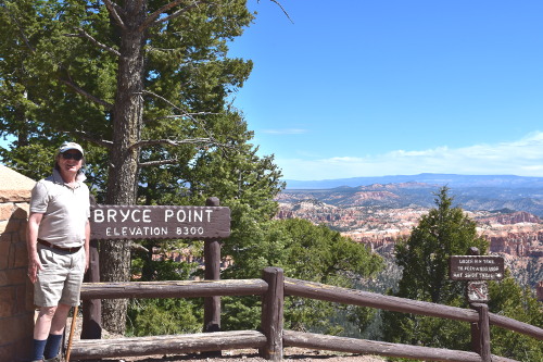
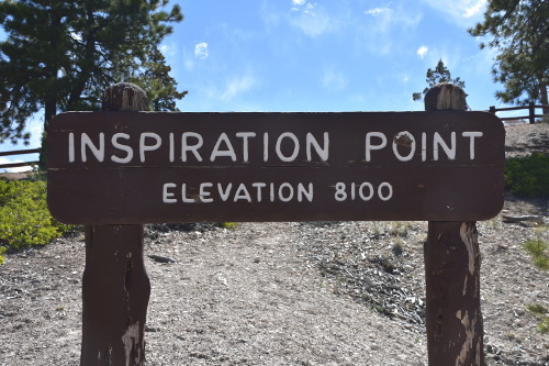
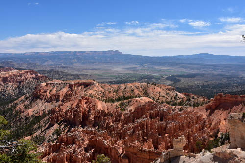
Bryce Canyon Inspiration and Bryce Points
Just past the Sunset Point, where I had dropped the crew off for their canyon hike the day before, is Inspiration Point and Bryce Point. We parked at both, and walked up to the observation areas and along the Rim Trails of each. The views are amazing.
The park in general is so well laid out and organized for the public. There is ample parking almost everywhere, and convenient locations for rest rooms and water. I suppose it gets a little crazy during peak seasons, but I think we hit it at a really good time. We had no issues during either day of our time in Bryce Canyon.
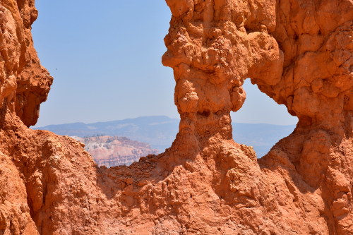
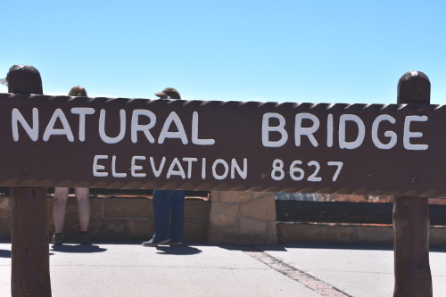
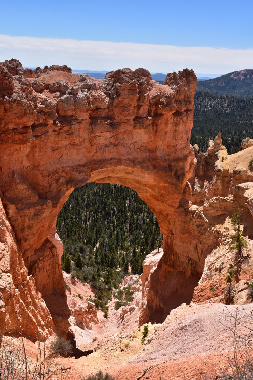
Natural Bridge
Though the name tends to be misleading, Natural Bridge is one of several natural arches in Bryce Canyon and creates a beautiful scene at this viewpoint. This arch, sculpted from some of the reddest rock of the Claron Formation (rich in iron oxide minerals), poses a stark contrast to the dark green of the Ponderosa forest that peeks through the arch from the canyon below.
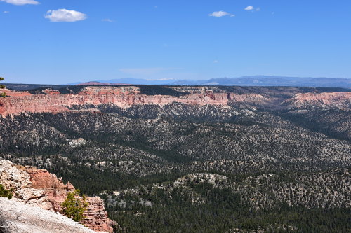
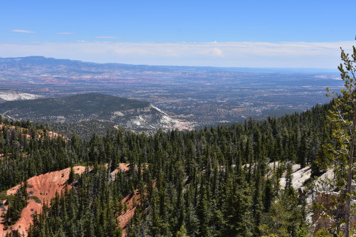
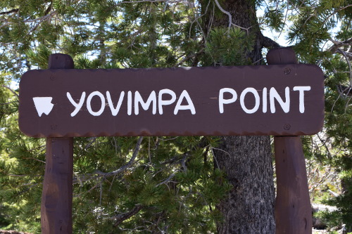
Out to the joint Rainbow and Yovimpa Points
The last public observation points in Bryce are 18 miles out from the Visitor Center. After stopping at the Paria View and quickly waling around there for a bit, we drove out to the joint points of Rainbow and Yovimpa.
Each sits on opposite sides of a sharply jutting ledge out into the canyon. Parking out here is tight, but it's well worth whatever it takes to get out and experience this. Note that one parking lot services both Points, i.e. you can easily walk across the parking area from one to the other.
All I'll say is that the views out here took my breath away. I hope the pictures Sue took enable you to get a sense for the indescribable beauty that stretches out before you, one of the furthest views in North America.
Here's a Yelp! review I wrote for Bryce Canon National Park:
Spectacular views leaving Bryce Canyon National Park
Back to K.O.A. and dinner
On the way back to the K.O.A. in Cannonville, Sue checked her walking pedometer, and she had covered 5.5 miles. Now, I had let her loose on one of the trails, but I must have done about 4 miles myself. And I had done about 3 miles the day before. I've been putting some miles on!
We drove back into Tropic for dinner at Rustler's Restaurant, which was almost next door to The Pizza Place from the night before. We hoped for something even marginally better, but were surprised at how wonderful the food and service was. It was so good that I wrote out a review of the food on a napkin, though lost that somewhere in our travels. Too bad because the food was so good, and our server, Carla, was spectacular.
We also discovered Redmond Real Salt. Mined in Utah since 1958 from an ancient seabed protected from modern pollution. Compared to Himalayan, Celtic, Tibetan, Malaysian, French, Hawaiian, Irish, and Marine Sea Salts, Real Salt means fewer food miles, ethical labor standards, and sustainable practices along with its addictive sweet-salt taste. The only American Pink and Black Salt. Got it on my shopping list!
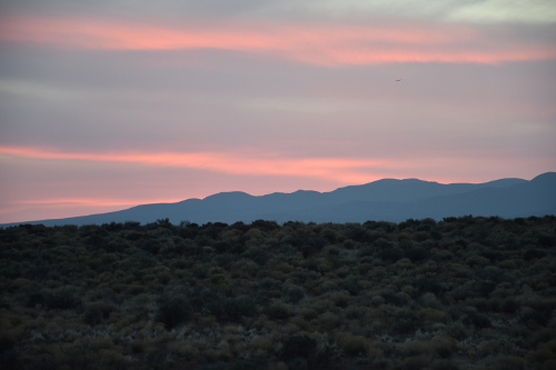
As darkness settled over Cannonville and the K.O.A., Sue experimented with taking pictures of the sun setting over the hills behind us, and then of Venus arching down over the horizon. It wasn't as dark here as at the Boulder Mountain Ranch because the campground is right on Highway 12, and there are several farms around that had lights on. Nothing annoying; just not the depth of darkness that would have been neat.
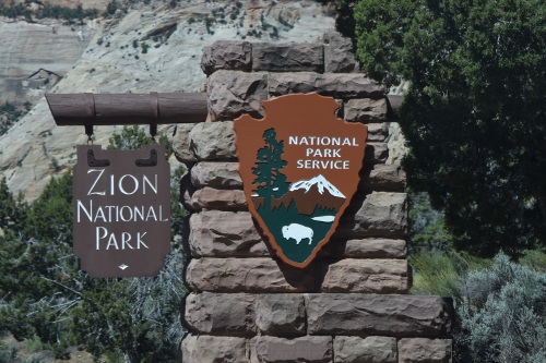
05/10/18 Thursday: Zion National Park
We left the K.O.A. about 8:30 and headed for Zion National Park after a quick stop at the entrance to Bryce at the Subway there for coffee and a couple of subs for lunch later in the day.
Our plan was to go to the visitor center, park there, get park information, and then take one of their scenic bus tours through the park. Everyone we asked said that because it was off season we most likely would not have to park in Springdale, that there shouldn't be any issue with finding parking near the visitor center as it was a huge parking area.
Getting there
The drive to the park's East Entrance is pegged at 1.5 hours, but we took a little over 2; a nice drive but nothing spectacular as far as scenery or dramatic vistas. We pulled off of Route 89 onto Route 9 in Mt. Carmel, and drove about 20 minutes to the East Entrance. The signs as we pulled onto Route 9 indicated that was the way to the park and to Springdale, where we figured we'd park if the visitor center was full. I only saw one sign indicating that to get into the park required a $30 fee at the entrance.
We thought this would be the main entrance where the visitor center was, but that's not the case: it's just a ranger pay station to get into the park. So, if you wanted to go to Springdale without paying the park fee and get to the West Entrance where the visitor center is, you'd have to not take this Route 9, but rather continue on Route 89, and swing way south and onto Route 389; about 2 hours vs the projected 1 hour through the park. This all is not made clear in any of the signs or material that we saw.
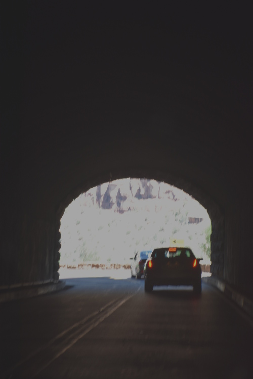
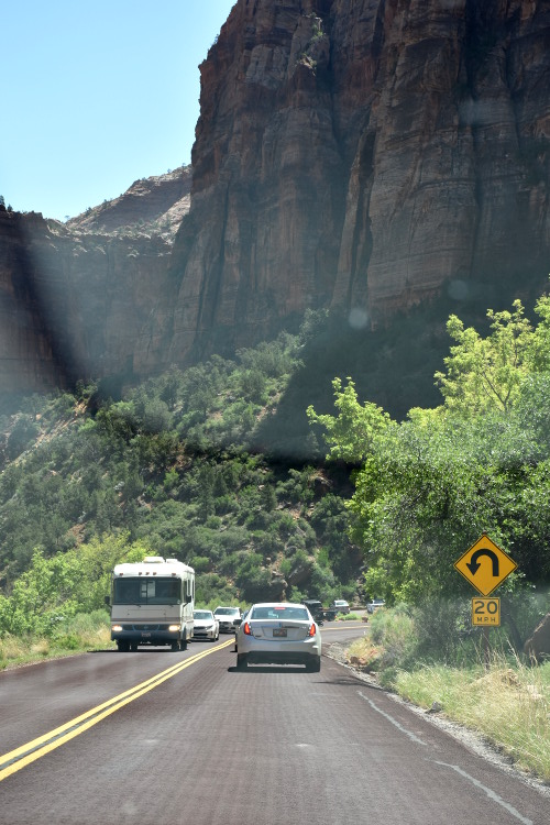
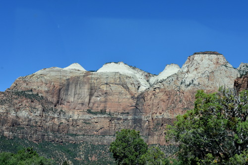
Regardless, we ended up at the East Entrance, paid the fee (actually, because we had our National Park pass, we didn't have to pay anything), and continued on that road through the park. From the East Entrance, it's another 12 miles of slow going, and mostly steep descending switch-backs to get to the visitor center at the west entrance in Springdale, UT.
The views along the drive are really, really nice. However, neither of us thought they were spectacular, but then we figured this was more of a open scenic drive, and that the bus tours would take you deep into the canyon - which they do, and I suspect those views are really dramatic. What we saw was nice, but it wouldn't be worth $30 if that's all you did.
And when we got there...
And what a zoo we ran into when we got to the visitor center! There were cars everywhere! I mean, there was not only no parking, but there were dozens of cars circling in and out of all of the areas cruising for a spot. Sue had to go to the restroom, and so I let her out in front of the visitor center by the flag pole, told her I'd cruise around and see if I could get a spot, and would meet her back at the flag pole.
There was no parking to be had; it was, like I said: just a zoo. I swung back and picked Sue up, and after plopping down heavily in the seat with a deep sigh, told me that the visitor center was like walking into a herd of cattle. She said it was awful.
I had seen the awful parking. There were people everywhere, and no sign that there would be any peacefulness to any visit here. Sue and I just looked at each other and said at the same time, "Let's get the hell out of here!"
And out the West Entrance we went! And right into Springdale and the masses of cars and people jockeying for paid parking along the roads and people walking all over the place. And both sides of the road are lined with everything commercial that you can imagine. Sue and I just looked at each other and said at the same time, "Let's get the hell out of here! And we're not—coming—back!"
And that was our visit to Zion National Park....
Here's a Yelp! review I wrote for the Zion National Park:
Plan B!
Since we had planned to stay 2 days in the area (at a tiny house in La Verkin), Sue had read about the Kolob Canyons area of Zion National Park as a possible other area to investigate. It's located at Exit 40 on Interstate 15, 40 miles north of Zion Canyon, and there's a five-mile scenic drive through it that sounded interesting.
So, we swung out of Springdale onto 15 and headed north. However, when we got to the exit, it was closed, as was the road to the canyon, and the canyons themselves due to road work: "Kolob Canyons road and trailhead access will be closed to all access beginning 5/1/18 until the fall of 2018." Terrific....
On to La Verkin
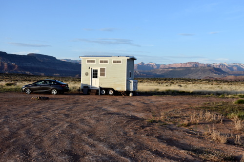
We drove back into La Verkin (elevation 3,192; population 4,161) and did some basic food shopping for dinner, snacks, and breakfasts. Because it was mid afternoon, I gave Jared, who owns the tiny home (he actually has a company that builds them, Zion's Tiny Homes), a call to see if it was ready. He was actually out at the site cleaning it up, and told us to come on out.
If you don't use direct GPS coordinates in this area, I don't know how you'd find these camps. You're out in the raw high desert on rutted, rocky, and soft sandy surfaces with nothing in sight for literally miles. Though we saw a couple of people driving around later that night, I would never want to try to come back here in the dark from town and try to find the location.
Shot of the tiny house where we'd be staying.
Desert floor leading up to the mountains to the west.
And the desert is not the place you want to be walking around in, either day, when the temps are near 100 degrees with all sorts of snakes and stuff crawling around waiting for you, or at night when you can't see anything. It's certainly beautiful in its own right, but 'City Boy' is way out of his element out here. Oh, but not Sue! Noooo.... She kept jumping out of the car to take pictures, and then when we were at the tiny house she was out wandering around in the desert, a big smile on her face, and camera at the ready!
It was nice to finally meet Jared as he had been so helpful responding to the many questions that I had about the area in the weeks before our arrival. He showed us around the tiny house ("June Bug"), and then headed out to get another house ready for guests.
After we got our gear into the place, we got in the car and headed off to a trail that Jared had told us might be interesting. But as we got out to investigate, it was registering 120 degrees on the car's thermometer, and I had no interest in walking though that! We just drove around for awhile instead.
Unfortunately, I got a text message concerning some issues back home that I was going to have to deal with immediately. Not much I could do today, but I was going to have to get somewhere there was good internet service to resolve all of this.
We found Jared and explained that we could only stay the night, and then we'd have to head into St. George. It's too bad because I'm sure Sue would have loved to roam around out there in the desert more than she was able to. However, later that day we took some time to drive back into La Verkin, and found the beautiful Confluence Park. It had a spectacular gorge with small churning river rushing through it.
When we got back to the tiny house, though the temperature was around 100 degrees, there was the nicest of breezes blowing across the desert floor. We set a couple of lawn chairs outside in the shade of the tiny house, got some water, and read for awhile as the sun began to slide below the mountains in the far west. Sue then cooked up our dinner for the night, just one of those frozen 'Dinner For Two' meals, and we ate that outside.
Night on the desert
As the sun set, the breeze was a little chilly against our sun burned skin, and we headed inside. Both exhausted from the disappointment of our Zion experience, we just called it a painful end to the day and went to bed. I had to get up, however, at around 3:00 am to go to the bathroom, and stepped out into the darkness of the desert, the twinkling of the stars the only reference I had.
I walked 30 or so feet away from the tiny home, and felt enveloped in the thickness of the night. I raised my arms in love and joy to Father Sky to the north, turned to the east, then to the south, and to the west, and finally back to the north. I was alone with the night; part of its blackness, and it's empty void full of life-truth. Quite a feeling for City Boy....
05/11/18 Friday: St. George
We were up and off from the tiny house early to head for St. George (elevation 2,860; population 80,202). We stopped at a McDonalds in La Verkin for coffee, and decided to take some back roads in rather than the expressway, Interstate 15 at 80 mph.
Sue was up early and caught the sun coming up over the mountains to the east.
As she took this picture, she could just see me climbing out of the tiny house....
... and took this picture of me waving at her.
We got on Route 7 that sort of loops around to the east and then down south past the airport and into St. George. Jared had mentioned Sandy Hollow State Park as a neat place to see, and so we drove to the front gate there as it's right off 7. But we didn't go in as it's really an RV and campsite park semi-circled around a pretty good sized lake that's actually a reservoir.
Right past the park entrance, 7 goes up a hill, and then bears off to the right toward the airport. However, we spotted a dead end gravel road right across from where 7 turned, and we scooted over to it. It was a fairly steep and rocky hill, but the views of the lake from up there were really nice. Sue got some nice pictures up there, as well as some by driving the opposite way along 7 about a mile or so. It was a really nice recreation area to have seen.
View of the Sandy Hollow State Park lake coming down the hill.
Picture of the red sandstone sandy beach at the Sandy Hollow State Park.
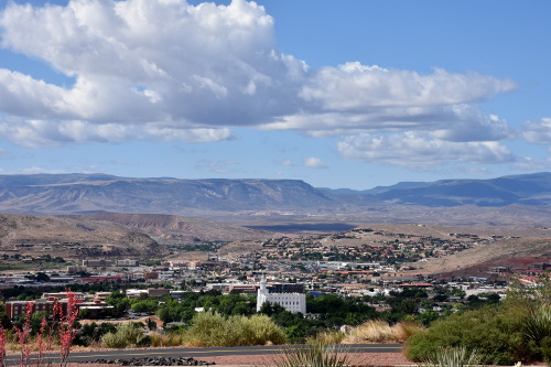
After coming down off the hill, we bore to the left and continued on 7 until getting off at one of the exits for Washington City. We were in no hurry, and saw that we could wander through Washington City, population 24,000, and eventually end up to the south of St. George. We were a little disappointed as it's not anything special, and pulled back onto the highway with the St. George Visitor Center keyed into Agnes, our GPS.
St. George Historic District
We had read about St. George's Historic District and were pleasantly surprised when we parked and went into the visitor center that we were right in the middle of it. Sue and I walked about 4 miles all around the area; it's just a really, really nice area.
The historic St. George Utah Temple. It was closed for renovation work, but beautiful to see.
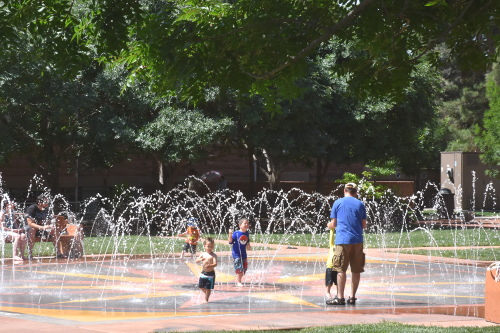
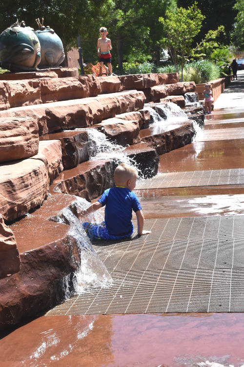
We started off in the Town Square. What a nice park! There were a couple of large tiled areas with multiple jets shooting water into graceful arcs that literally dozens of little kids and their parents were playing in. There was attractive landscaping throughout the park, with a couple of stretches of low rocky waterfalls.
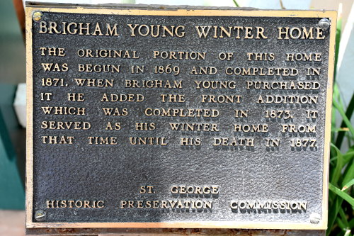
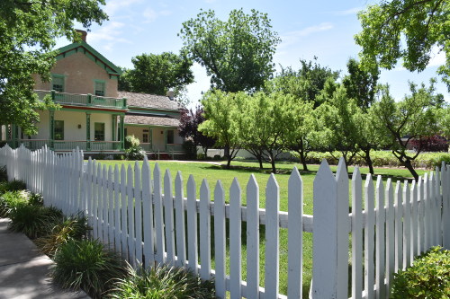
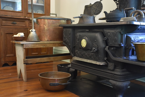
After exploring several other sites on the tour map, we headed up to the former winter home of Brigham Young, an American leader in the Latter Day Saint movement, politician, and a settler in the Western United States. He was the second president of The Church of Jesus Christ of Latter-day Saints (LDS Church) from 1847 until his death in 1877. He founded Salt Lake City and he served as the first governor of the Utah Territory. Young also led the founding of the precursors to the University of Utah and Brigham Young University.
We had a marvelous hour lecture and tour of the home. Young was quite an historical figure, and one I'll do more research on. In fact, one of the guides offered me a copy of The Book of Morman after explaining how their teachings folded out of the historical bible.
Here's a Yelp! review I wrote for the winter home of Brigham Young:
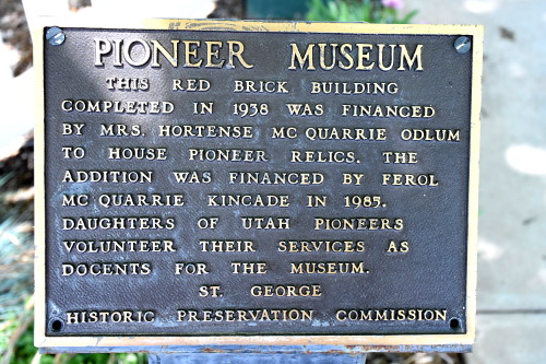
We then visited the Daughters of Utah Pioneers Museum. Greeted so warmly by the docents when we entered, we were excited to have one of them guide us through the museum. It turns out that her great (possibly great-great) grandfather was one of the original 309 "saints" to be sent by Brigham Young to colonize St. George - which got its name from George Smith, one of Young's principal consolers who led the effort.
Here's a Yelp! review I wrote for the Daughters of Utah Pioneers Museum:
It was a great tour, but it was around 2:00 pm and I was beat from all the walking. And we were hungry! A sign in the One Hot Grill for hot dogs caught our eye. In we went, both getting Chicago Dogs. Outstanding!
Checking in at the hotel
After grabbing a bite to eat, we walked around the historic district for just a while longer until we felt we had covered most of what interested us to see.
The La Quinta Inn and Suites where we had hotel reservations was only a short 12 minute drive from the historic district. It didn't take us long to get checked in and up to the room. Sue wandered off to investigate the pool, and came back all geared up for a swim. I don't usually swim, but I do like to sit around a pool and read, so off we went.
Here's a review I wrote for La Quinta for both TripAdvisor and Yelp!:
It was a nice pool, but after about an hour we were getting pretty hot from the sun, and it was in the 90s. We came back to the room and cooled off with showers. While Sue was in taking hers, I did some research on places to eat. We selected an Indian restaurant, Bombay Cafe. It was only about a 12 minute drive, located in one of St. George's open malls. And the food was really good!
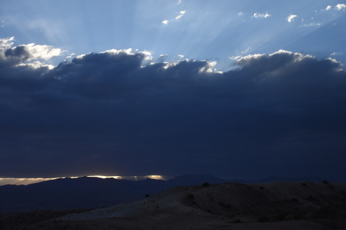
Clouds rolling across the horizon as dusk begins to creep over the mountains.
The clouds got progressively more menacing as we drove back to the hotel.
We're pretty sure it rained hard across the valley as this was just really dramatic.
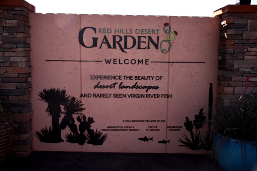
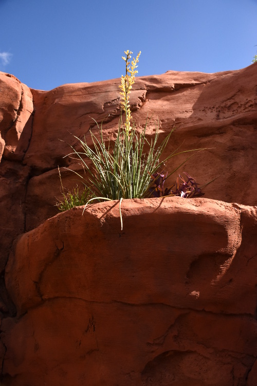
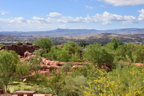
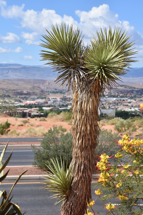
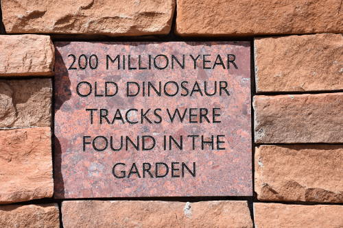
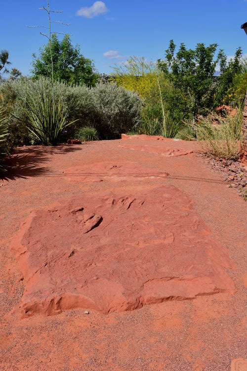
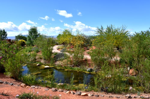
Red Hills Desert Garden
After a good breakfast at La Quinta, we headed out over 375 East to the Red Hills Desert Garden. This is a 5-acre preserve with more than 5,000 desert plants, a stream, replica slot canyon & dinosaur tracks. There are all sorts of trails that criss-cross the gardens off of the main walkway that loops around the entire park. I think we spent well over an hour browsing over everything.
I really enjoyed waling around here. In fact, it was one of my favorite spots that we've visited on our trip. I'm so glad that we grabbed an extra day in St. George so that we could go on so many neat adventures. I could come back and spend a week in the St. George area, it's that interesting.
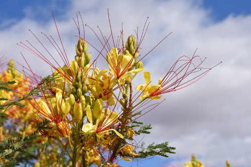
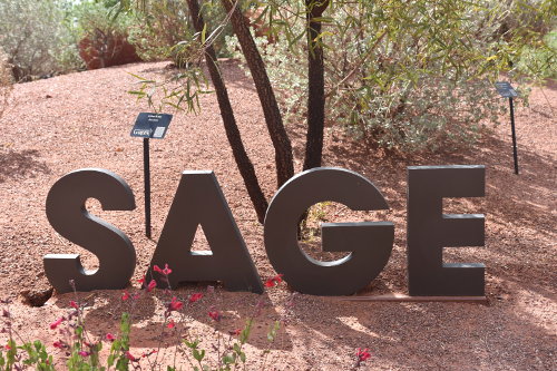
Anyway, Sue got some terrific pictures of the gardens, and a bucket full of all the different plants on display. Interesting for me is that I like to cook with sage, but here there are so many different kinds of sage plants that I'm going to have to do some research on this plant. I'd like to know what sage plant the Indians use as smudge sticks in their ceremonies, which sage is best for cooking, etc.
I think I forgot to mention that early on in the trip I had been walking along in the desert with Sue and had broken off a sage branch that I laid in the back window of the rental car. It gave the car such a nice, clean scent. Wonderful. And here were several different kinds of sage, each with it's own slightly different smell.
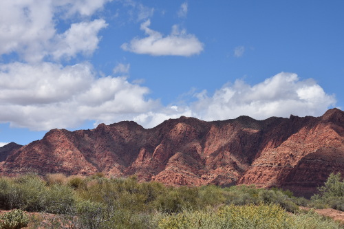
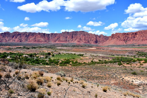
Red Cliffs Desert Reserve
Adjacent to the Red Hills Desert Garden is the Red Cliffs Desert Reserve, a 62,000-acre scenic wildlife reserve set aside to protect the Mojave Desert tortoise and other rare plants and animals.
The Reserve was established in 1996 to protect a large, diverse, and functional expanse of habitat capable of sustaining wildlife populations threatened by rapid development and habitat loss across Washington County in southwestern Utah.
We first traversed up the cliffs to the left of the access trail. There was a really interesting hole through the rocks that Sue climbed up further to take some pictures of. I went about half way up, and then Sue continued on while I returned to the car to read as I'm not a desert hiker. But Sue was gone for over an hour, having the time of her life snapping pictures and enjoying tromping all over the desert cliffs and hills, as well as a search for the elusive desert tortoise.
I brought 'Janis' with me everywhere. For the most part, haven't needed her in years, but she does come in handy sometimes when the trail gets a little steep.
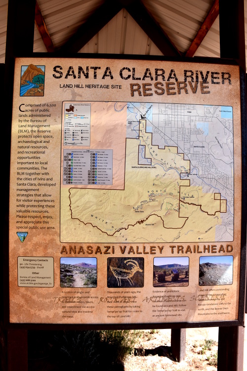
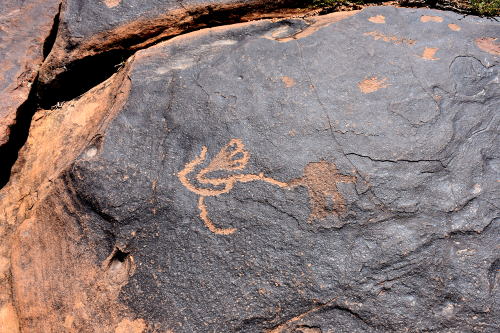
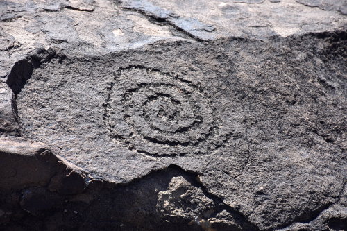
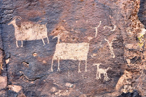
Then we were off to see the petroglyphs from the Anasazi Tribe along the banks of the Santa Clara River southwest of Ivins on what's called the Tempi'po'op Trail.
I walked around on the trail for awhile, but then let Sue continue on the 3.5 miles because, as I've mentioned, I'm just not much of a desert hiker. I went back to the car and continued to read PrairyErth, enjoying the gentle breeze that blew down off of the surrounding cliffs.
But she got some really interesting pictures of the petroglyphs, just a few of which I'll post here to give a sense of how amazing this work is.
Sue got some great pictures on the way down from top.
Sue took this picture of the parking lot as she was coming down the trail. I was parked in the black car facing the fence.
Sue had such a good time on that hike. I'm glad that she had read about the park and wanted to come as I enjoyed seeing what I did of it, and seeing how much she liked it.
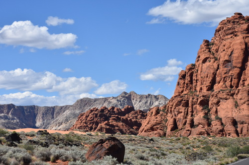
Snow Canyon State Park
Our final adventure for the day, and, unfortunately for our trip as well, was a pleasant 20 mph drive through the Snow Canyon State Park, a 7,400-acre scenic park quietly tucked amid lava flows and soaring sandstone cliffs in a strikingly colorful and fragile desert environment.
Interestingly, many movies have used this area for their backdrops, including one of my favorite, the spectacularly crafted 1972 Jeremiah Johnson.
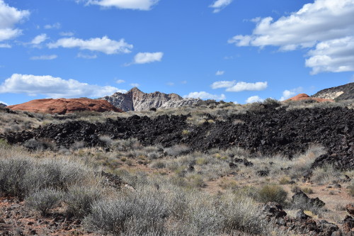
The ranger at the pay station ($6 per car) said to be sure to stop at the Lava Flow pull-over as it best represented the black lava rocks so prevalent in the park. We did that, and it's a pretty stark scene in contrast to the surrounding cliffs and desert vegetation.
You can see the difference in the rocks where the lava appears black against the reddish sandstone.
We had specifically selected this park as our last stop as the park road, going north, terminated onto Highway 18 which would drop us right back down into St. George.
Dinner in St. George
We took showers after getting back to the La Quinta Inn and Suites in St. George, and then headed off for a wonderful dinner at Cappelettis Restaurant in the Historic District.
The food and atmosphere were wonderful. But, because we had a 6:30 am flight out in the morning, it was an early dinner, and we headed back to the hotel early.
Here's a Yelp! review I wrote for Cappelettis Restaurant:
05/13/18 Sunday: Back Home!
The alarm went off at 4:30 am, and we were out the door and inside the St. George Regional Airport by 5:30 am after returning the rental car.
The airport was recently transformed from a little puddle-jumper terminal to a quite nice facility. But there is currently no food or coffee, or any services beyond just checking in and getting on the plane. Which was fine for us as we had stopped at a convenience store on the way back from Cappelettis the night before and grabbed muffins which we ate before leaving the hotel this morning.
It was just a short flight up to Salt Lake City, anyway, and so when we got in, we got something to eat there. It was pretty relaxing as we had about an hour and a half before boarding the Delta flight back to Boston.
The Salt Lake City airport is really nice, with a lot of new construction going on. It reminds me a lot of BWI, the Baltimore-Washington airport. I don't care for how Delta boards passengers, though. After they do the kids and perk groups, it's just a cattle call at the gate. I like that you have reserved seats, but they don't queue you in; it's everybody for themselves and causes delays in boarding. I like the way Southwest lines you up in boarding pass order, but then they don't have reserved seats so it's a mess as well. Gad, it's just a computer flag on the ticket and a little thought at the gate and you could easily combine both of these features....
The flight back to Boston was long, 5.5 hours. But at least it was smooth, and I was able to finish PrairyErth. What a super book, as I've said. I need another trip now so I can take his Blue Highways along to read!
Back to reality....
I read a quote once that said: "Reality is where the pizza guy comes from." Love it.
Well, reality for me was coming home and then firing up the Cub Cadet lawn mower to cut the 4 inch high grass that had grown while we were gone, and blow out the main rotor blade belt. Terrific....