Back to Peter's Home Page | Back to Family Home Page
|
|
Mt Desert Island, ME Vacation 02/03/12
|
|
On Friday 02/03/12 we packed up the car with photography and snowshoeing gear and headed north for a weekend trip to Maine’s Mr. Desert Island. Sue had wanted for years to go up to take winter photographs of probably one of the country’s most spectacular islands, and we decided to combine that with my first attempt at snowshoeing.
Well, the photograph part went better than expected but I'd just speculate that Miami Beach had more snow than we found up there! Of course, being an island sticking way out into the Gulf of Maine had something to do with it, but even the locals said that snowfall had been really sparse, though most of the roads through Arcadia National Park were closed due to ice.
We decided to take the coastal route all the way rather than just shooting up I95. I wasn't too concerned about doing that this time of year when most everything was closed up and tourists were as scarce as volunteers for cleanup after a cub scout meeting.
|
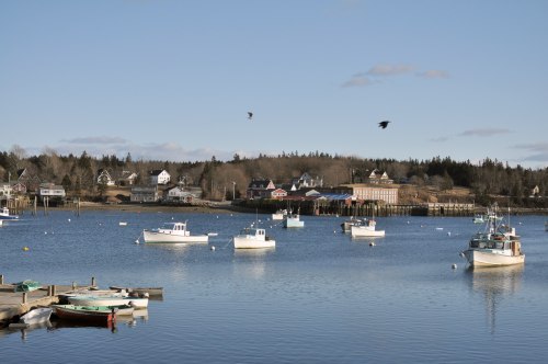
It was a beautiful drive and we made great time all the way into Rockland, ME. We made a side stop to Owls Head Light. Rockland Harbor was once one of the busiest harbors in the world and this lighthouse has a magnificent history to it - which I'm not going to go into here; you can go to the hyperlinked site. We walked out around the waterside rim and the wind was pretty intense so we didn't linger too long.
|
The coastline approaching Rockland, ME.
|
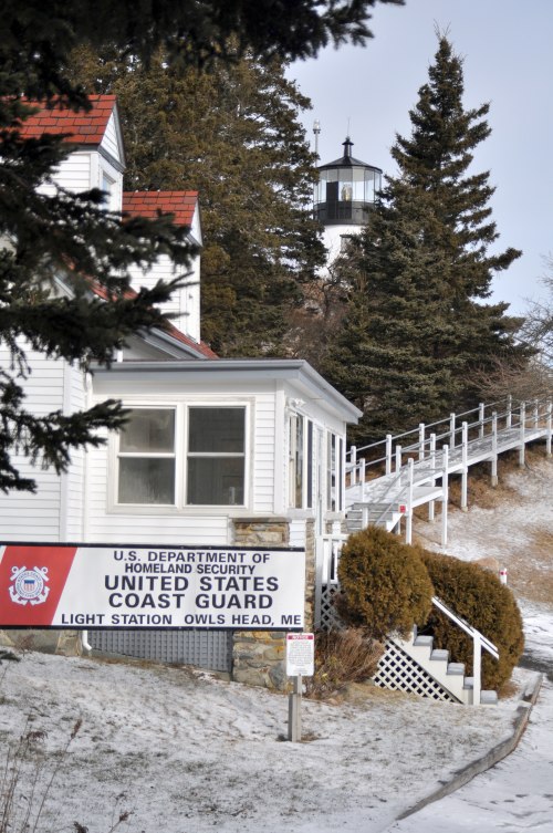
Path up to Owls Head Light.
|
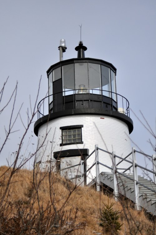
Owls Head Light.
|
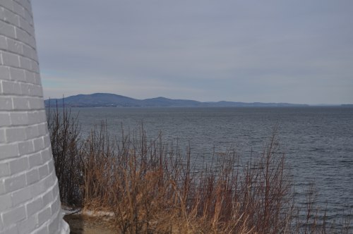
Looking North from Owls Head Light into Rockland Harbor. Be sure you go to the website because the history of this lighthouse is amazing!
|
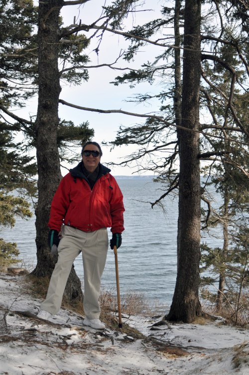
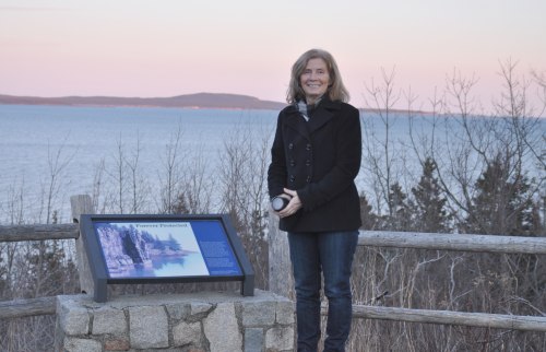
I just had to have Sue get a shot of me here!
|
After that, I drove the side streets of Rockland along the water, impressed at so many new interesting looking shops all along main street. When I first came up to Rockland 40 years ago, and even as late as 25 years ago, it was pretty much a working town not too interested in tourists. It’s a nice change, though I hope they control the growth so it doesn't turn into something ticky-tacky like Hampton Beach, NH.
|
Along the coast from Owls Head toward Rockland.
|
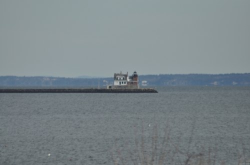
The 3/4 mile long Rockland Harbor Breakwater and harbor lighthouse.
|
We did get out of the car in Camden, ME and walked around a little. Sue had wanted to stop at Stone Soup Books where she had gone with her son Lucas many years before. What a place! Up a flight of bare, creaky, wooden steps off the main street, you walk into this tiny floor to ceiling book packed room and are immediately overwhelmed with the magnitude of the experience.
Though amazing, I was starving after about 40 minutes so we went next door to the Camden Deli for a wonderful lunch of half of a Portobello mushroom sandwich and one of the best tasting chowders I've ever had. The deli itself is perched right over the falls and we had a terrific table right at the back windows overlooking Camden Harbor.
|
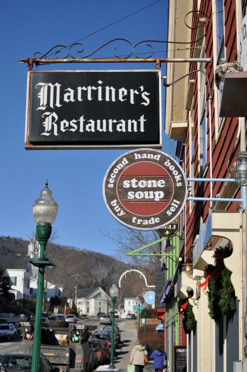
Sue wanted this shot of the sign for the Stone Soup Book Store that she took me into because she and her son Lucas had spent many hours browsing in there. It is one of the cutest little book nooks that I have ever been in. Check it out if you're in Camden if you like that sort of browsing.
|
This is a shot out of the back window of the Camden Deli where we had lunch.
|
Hummmmm....
|
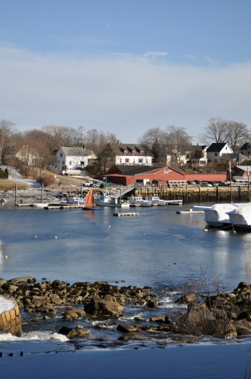
From Camden, I drove Sue over to Rockport Harbor to see the lime kilns, the statue of Andre The Seal, and the neat little stores that have cropped up. Most everything was closed, and so we didn't go anywhere else than the harbor park before continuing north on US Rt. 1.
|
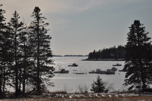
Sue took this shot from the little bridge that connects the Rockport Harbor Park to the boat yard.
|
From the boat yard looking over toward Rockport.
|
Andre The Seal looking out over Rockport Harbor.
|
Leaving Rockport, we pressed north to Belfast, ME.
|
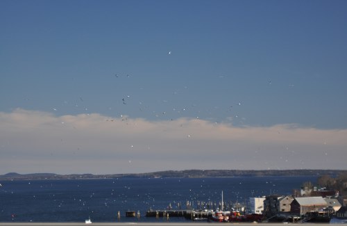
This is a long shot of Belfast Harbor. I had always wanted to see what Belfast was all about and I can't tell you how impressed I was! What a beautiful village! It’s perched right on Belfast Bay with the nicest, quaint feeling downtown area.
Very similar to Camden, but more arts and small shop oriented. We got out of the car down at the town dock, braving that for as long as we could stand the biting wind that had churned up rows of cresting whitecaps all across the bay. We only have this one shot because we could have probably filled a 4gig card just with shots; but we were a little pressed for time.
So, back in the car and off we were again!
|
It’s such a beautiful ride up through Searsport, Bucksport, and across to Elsworth where we broke right and headed south on Rt 3.
|
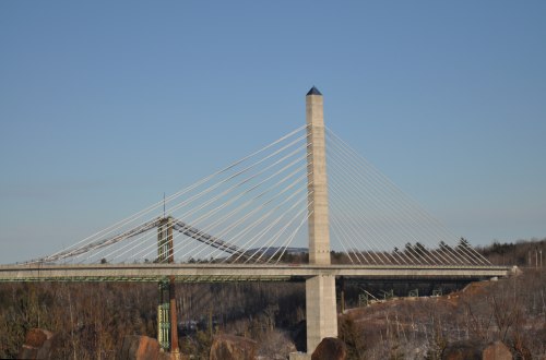
Sue got this great shot of The Penobscot Narrows Bridge spanning the Penobscot River in Bucksport, ME.
|
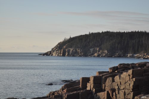
I have no clue as to where this picture was taken, but it is indicative of the beauty of the Northern Maine coastline.
|
We were actually running a couple of hours later than we had originally planned. We had wanted to get checked into The Hummingbird Suites just north of Bar Harbor and then head up to Cadillac Mountain in Arcadia National Park so Sue could take pictures at sunset.
But, it was already close to 4:00pm and sunset was around 4:43 so we decided to head straight for the park. Unfortunately, when we got there, the loop road up to the mountain was closed due to ice. We did meet a really nice local guy walking his dogs and he directed us to Thunder Hole which he said was not only interesting but the light, even though facing the opposite from sunset, would be really nice.
So, off we went! Though not the real sunset Sue had hoped for, we knew we could find a better place Saturday afternoon, and so we headed back up to the suite to check in with Donna and get a real locals view of all the neat places on the island to not only hike around but to get great photographs.
|
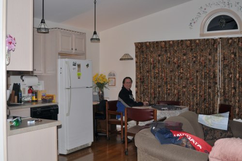
A shot of our great accomodations at The Hummingbird Suites. I'm logged in and checking out maps and directions for exploring the area.
After we got unpacked, I poured out a glass of wine, and Sue and I battled through a set of 3 backgammon games before heading out to dinner. Sue had done some research and thought that McKays Public House would be nice. And it was; just a really nice quaint dinning place with great food.
|
Out the door at 6:30am Saturday morning to catch sunrise at Hulls Cove at 6:47am, just a mile down the road from the suite, actually. It was spectacular! But then we jumped in the car and headed back over to Thunder Hole and backtracked to Sand Beach for additional shots. Finishing that, we headed back to the suite to plan out the day.
We had actually planned on snowshoeing Saturday morning, but with no snow: that wasn't going to work too good. We went over our map, circling all of the places Donna had suggested would be interesting and headed out for the adventure around the coastline of the island at 9:30am.
We first had a mandatory Susan stop at the local convenience store for much needed coffee and a muffin for breakfast! And then, I just pointed the car south on Rt. 3 and off we went for our first explore to the Seal Harbor area and ‘Millionaires Row’ where Martha Stewart and the Rockefellers, among others, have spectacular homes, though tough to see. But the drive is really nice!
|
Sue took this great shot of the sunrise at Hulls Cove at 6:47am.
|
Along the coast.
|
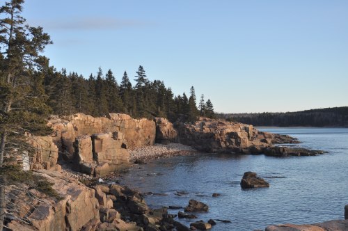
Along the coast.
|
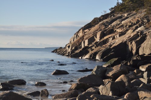
Along the coast.
|
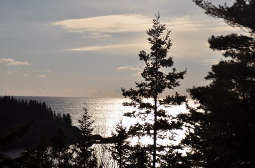
Settling into the folds of the sunset.
|
We took Cooksey Drive to a tiny little parking area off to the side of the road that Donna had told us about. From there, we took a very icy and rooted half mile long trail down to the shore to what I think is Hunters Beach. Anyway, Sue took pictures and we combed the rocks for sea glass and generally had a great time exploring before hiking back out.
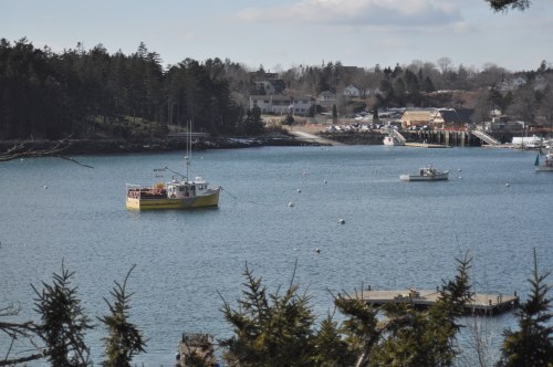
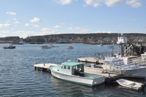
We worked our way slowly along the coast and into Northeast Harbor, where we watched some kind of party boat or whale watch load passengers.
|
Working our way along the coast toward Northeast Harbor
|
|
|
We then headed up the east shore of the spectacular Somes Sound to the top at Somesville and dropped down its west shore on Rt. 102 to Southwest Harbor where we stopped at Breakfast At Grumpy’s for a wonderful, and very unique lunch overlooking Southwest Harbor.
|
Eastern shore of Somes Sound.
|
Eastern shore of Somes Sound.
|
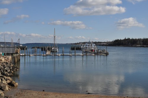
Southwest Harbor.
|
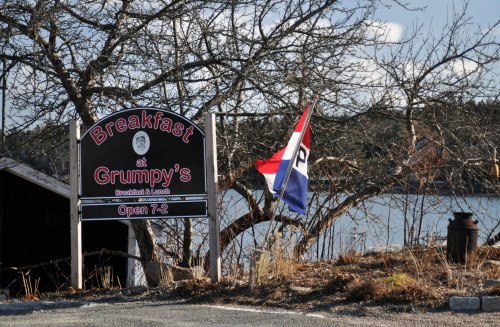
Breakfast At Grumpy’s for a wonderful, and very unique lunch overlooking Southwest Harbor.
|
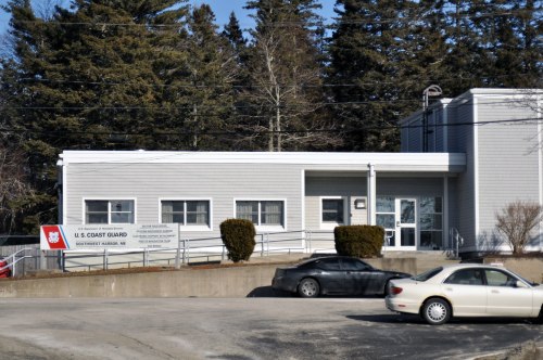
From Grumpy's, we backtracked about a half mile and went out on the eastern side of Southwest Harbor to the Coast Guard station. Not much to do, but again it was the adventure of it and for pictures!
|
Eastern shore view of Southwest Harbor.
|
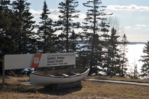
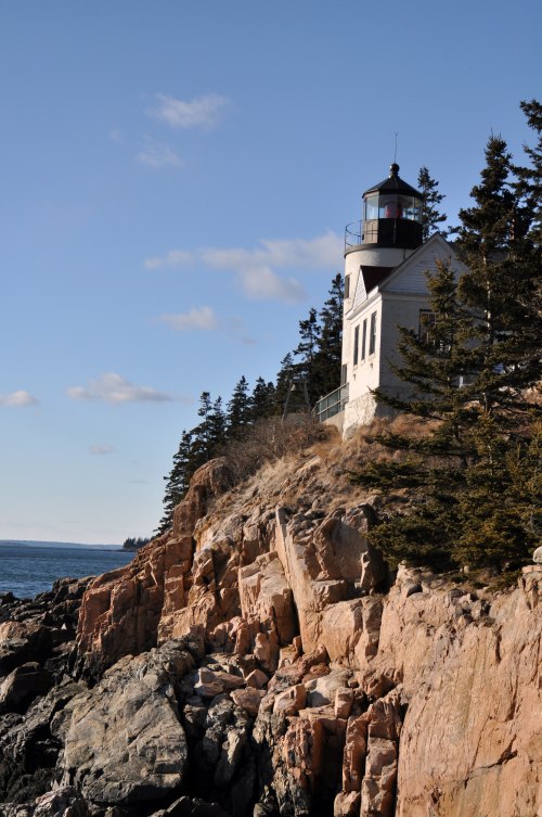
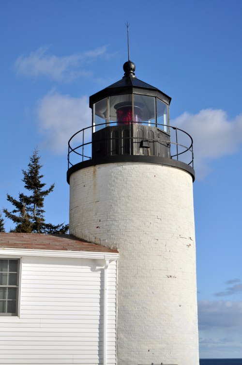
From Southwest Harbor, we side-tracked down Rt. 102a to the Bass Harbor Lighthouse. What a spectacular event that was! It’s built into the side of the cliffs overlooking the entrance to Bass Harbor and Blue Hill Bay. We had a lot of fun on both access trails to it, though the southern trail was really steep stairs that seemed to just drop off into the bay far below and I had to end the walk when it turned into just a boulder climb, though Sue got some great shots out on them.
|
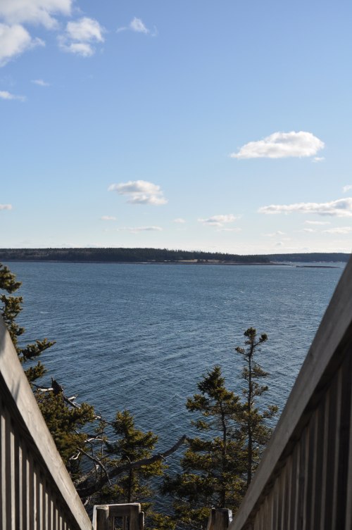
You can walk down these stairs to a rock path high above the water to get a bottom up look at the Bass Harbor Lighthouse.
|
The view up at the lighthouse from the base of the trail - which I did not choose to brave....
|
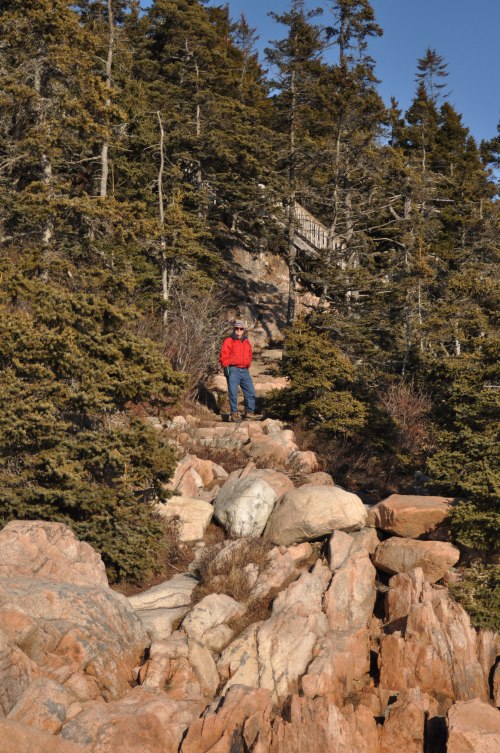
Sue, however, did make the trek all the way out to the bottom of the path and got this shot of me.
|
Back at the Coast Guard Station.
|
This is the view of Bass Harbor Light from the side of the Coast Guard Station. It's basically viewing the lighthouse from the opposite side from where Sue took the picture of it from the base of that rock path.
|
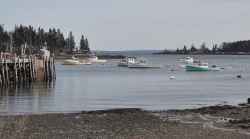
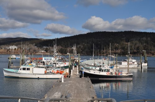
From the lighthouse, we looped up around Bass Harbor and down into Bernard where we got out at the town docks. It was a long, long time ago, but my friend Dan Craig and I sailed into and moored for the night in Bass Harbor. We had taken the dingy to this very dock looking for somewhere to grab a bite to eat. I'm not sure what happened, but I've got vivid memories of being woken up at 5:30am to the roar of a half dozen lobster boats firing up for the trip out to their traps. This was strictly a working harbor then, and I saw no evidence that it was any different now, some 20 years later. No ‘yachts’ here — even today.
|
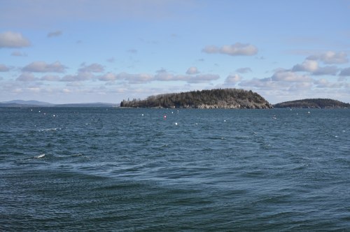
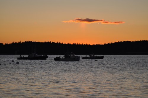
From Bernard, we drove up to Pretty Marsh Harbor, taking Bartlett’s Landing Road down to the dock. We knew right away that we just would not get a better place to take pictures of the sunset in 45 minutes, so we decided to just stay there and wait. The island across from the docks is Bartlett Island where most of the houses belong to the Rockefellers. That would be the backdrop of a great series of pictures that Sue got.
Since we had awhile before we'd have to set up the camera, we walked way up the beach and across the short neck to the other side facing Pretty Marsh Harbor itself. But the wind was just brutal all around and we hustled back to the car through the woods to avoid the cold. Just before sunset, I carted the tripod out on the beach, and Sue and I climbed up onto a large floating dock that the fishing boats used at high tide. It was a long and cold shoot, but that’s the only way to get shots like she got.
|
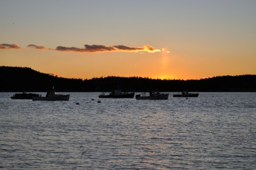
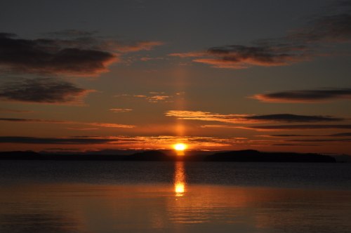
Of the dozens of shots Sue took, this one and the next were in a series shot over about 5 minutes and are pretty representative of the beauty we were fortunate to experience.
|
The sun just easing down behind the hills in the distance.
|
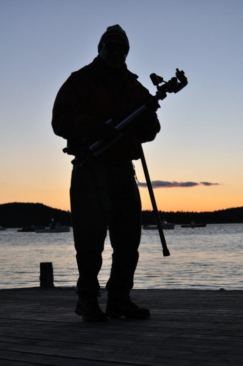
Time to load up the gear and head for the car.
|
After that, we continued up Rt. 3 to the top of the island, and then back down the east side to the suites. We were both beat, so we had leftovers from Grumpy’s, played some backgammon, and went to bed around 10pm. We didn't wake up until 9:00am!
We did a quick pack up and were off for the drive home fairly quickly, stopping at a little store up the road for coffee and muffins. We were having such a good time that we decided to just take the coastal route back and not worry about shaving 15 minutes off the time by going over to 95.
We did stop again in Belfast, ME, this time taking a more detailed drive around town to scope it out. What a really neat place; I think I'd like to come back and just spend a weekend here! But in the summer because it was really, really cold and windy!
We just sort of poked our way down the coast stopping for a really nice shopping adventure at Mexicali Blues in Newcastle, ME just south of Damariscotta. We stopped for lunch in Wiscasset at Sarah's Cafe. Winter is probably the only time that we could do this because in the summer you could take 2 hours getting across the bridge from either north or south; we know the long way around so always avoid Wiscasset, which is a shame because it is such a pretty little village right on the Sheepscot River. But if you're brave or catch the traffic right, be sure to stop here to eat!
Well, we got home around 5:00pm, unpacked, and played backgammon, watched the first half of the Patriots and Giants in the Super Bowl while eating delivered Chinese food. Neither of us are really big football fans and the first half was all we could take (Pats ultimately lost 21-17) so the movie of the night was the third in the Bourne series, Bourne Ultimatum
|
Back to Peter's Home Page | Back to Family Home Page
|